Whatever they are and from where, UFOs, now known as Unidentified Anomalous Phenomena or UAP, are the subject of serious scrutiny at the highest levels of the U.S. government.
In June 2026, the White House established a new UAP Science Advisory Council in coordination with the Pentagon's All Domain Anomaly Resolution Office, the Office of the Director of National Intelligence and the FBI Deep diving into the UAP landscape is Avi Loeb, noted Harvard astrophysicist. He is also director of the Galileo Project at Harvard, which aims to search for signs of extraterrestrial activity here on Earth. As the council chair, Loeb said the goal of this group is to advise the U.S. government on how to resolve the nature of UAP.
Members of the UAP Science Advisory Council recently gathered at a private meeting, held on Aug. 31 at the Office of the Director of National Intelligence, Loeb told Space.com. "I cannot disclose the contents but I will say that the U.S. government is sincere in its efforts to understand UAP based on the scientific method of data collection," Loeb said.
Council membership
One of the council's members is Ben Lamm, co-founder and CEO of Colossal Biosciences. As a serial technology entrepreneur, he's no stranger to diving into complex challenges. Colossal is advancing the use of genome editing technology to "de-extinct" previously lost species such as the Wooly Mammoth.
Working along with the council's group of scientists and experts, Lamm is bullish about bringing clarity to a long-standing investigation and wonder of UAP.
"I've been fascinated by this topic for a long time, so having the opportunity to help examine the evidence firsthand and contribute to a serious scientific effort is incredibly exciting," Lamm told Space.com.
"Our mission is straightforward," Lamm added. "This is not about belief, it is about evidence. We want to apply rigorous scientific methods to both historical UAP records and new observations, collecting and analyzing data that meets today's scientific standards," he said.
Lamm said that the expectation is to bring transparency and accountability to the field by objectively evaluating credible evidence and sharing findings openly with the scientific community and the public.
"It's time to search for answers around the science because they could reshape our understanding of the world and, potentially, become one of the most significant discoveries in human history," said Lamm.
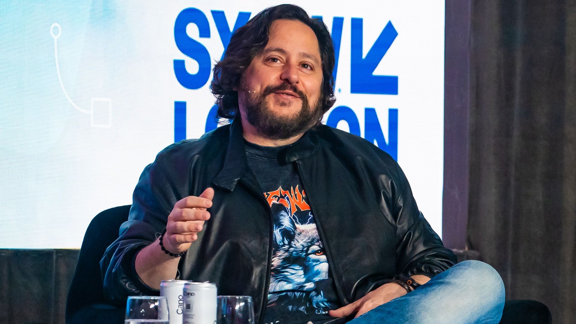
Ben Lamm at SXSW London 2025 on June 03, 2025 in London, England. (Image credit: Lorne Thomson/Redferns/Getty Images)
New polling data
Meanwhile, and serving as a backdrop to studying UAP, is a new Gallup poll, conducted in July. That poll found that about half of Americans, 49 percent, think all Unidentified Flying Object (UFO) sightings can be explained by human activity on Earth or natural phenomena.
The poll also found 37 percent believe at least some UFOs have been alien spacecraft visiting Earth from other planets or galaxies while another 13 percent do not have an opinion.
Interestingly, rather than becoming increasingly convinced that some sightings have been alien spacecraft, the percentage of Americans who are unsure has grown, from 7% in 2019 to 13% in 2026 the Gallup poll found.
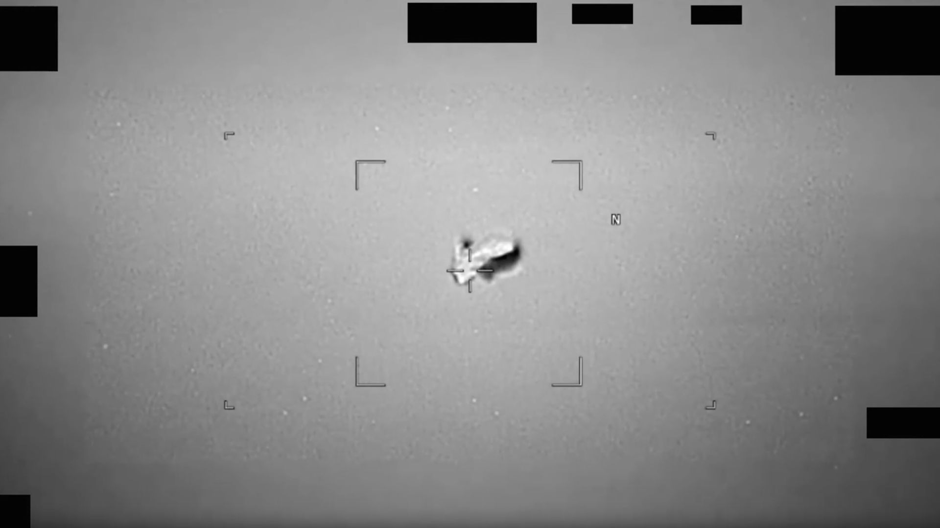
A "football-shaped" UAP (unidentified anomalous phenomenon) observed by an infrared sensor on a U.S. military platform in 2024. The Pentagon released this observation on May 8, 2026. (Image credit: U.S. Deparment of War)
The new poll also notes that a majority say the U.S. government is withholding UFO information. Seventy-eight percent of Americans say the U.S. government knows more about UFOs than it is telling the public, higher than the 68 percent and 71 percent who said so in 2019 and 1996, respectively.
In August 2026, the UAP Science Advisory Council announced their support for the Trump administration to provide legal assurances, including immunity where necessary, for current or former government employees and military personnel to share information with the council "regarding alleged technology from a non-human origin and help guide the council's scientific evaluation."
China is making progress on its Tianwen 3 Mars sample return mission, which aims to bring back to Earth roughly 500 grams (17.6 ounces) of Red Planet collectibles in 2031.
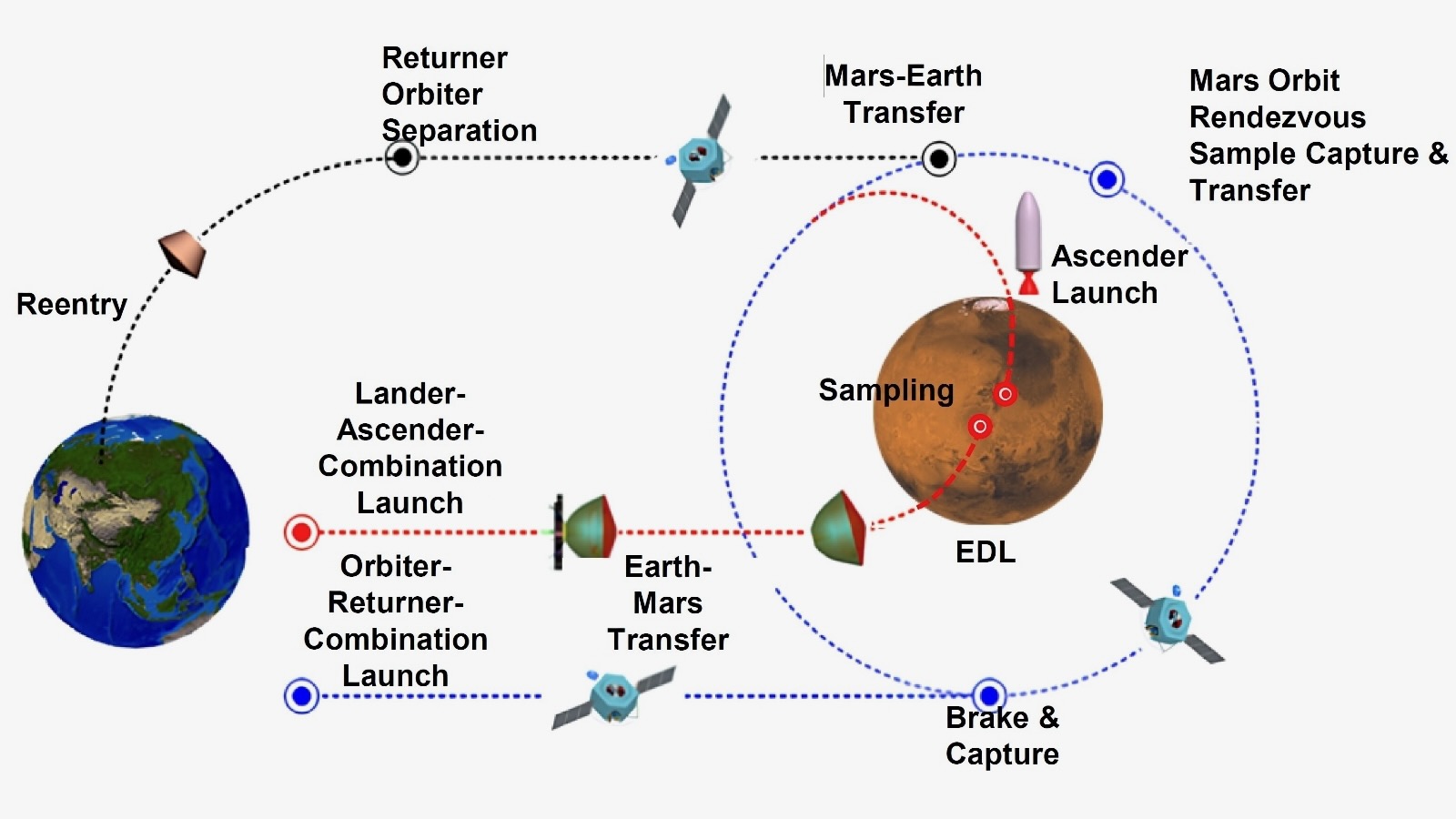
According to the China National Space Administration, the Tianwen 3 mission will have a lander, an ascender, a service capsule, an orbiter and an Earth reentry module.
If all goes to plan, Tianwen 3 will launch in 2028 on two Long March 5 heavy-lift rockets from the Wenchang Space Launch Site on the island of Hainan, China's southernmost province.
Sputnik moment
"The Tianwen 3 mission is progressing smoothly, with intensified efforts being made to overcome technical challenges," Hou Zengqian, the mission's chief scientist, recently told CCTV, a state-run Chinese broadcaster.
"The probe equipment has entered the prototype development phase, and scientifically, many scientist teams from across the country are working together to tackle the challenges in accordance with the mission's scientific objectives," Hou added.
Meanwhile, NASA's plans for hauling Mars samples to Earth are murky at the moment. So China appears to be in the lead to notch a major space milestone.
"If accurate, this represents a Sputnik moment," said former NASA "Mars Czar" Scott Hubbard, referring to the reported Tianwen 3 progress.
"China will not only grab the headlines but may be the first to find evidence of life on another planet," Hubbard, who also previously directed NASA's Ames Research Center in Silicon Valley, told Space.com.
Diagram of China's Tianwen 3 Mars sample return mission. (Image credit: The University of Hong Kong/Zengqian Hou, et al.)
Top scientific priority
"The Tianwen 3 mission will look for microbial traces potentially similar to early forms of life on Earth, while also taking into consideration the possibility of unknown forms of life that may have emerged through Mars' unique evolutionary history, providing crucial evidence to answer this major scientific question," Hou told the state-run Xinhua news agency in a recent interview.
Searching for potential signs of life on Mars is the top scientific goal of the Tianwen 3 mission, Hou said on Sept. 3 during the 2026 International Deep Space Exploration Conference on, which was held in Hefei, the capital of eastern China's Anhui Province.
Landing site
China's Mars sample-return trek will be launched "around 2028" on two Long March 5 rockets departing from the Wenchang Space Launch Site in China's southernmost island province of Hainan. (Launch windows for Mars missions come around just once every 26 months. The next one opens in November-December of this year, and the one after that, which Tianwen 3 apparently is targeting, runs from December 2028 to January 2029.)
Hou also said China expects to finalize the landing site for the mission by the end of 2026, with Chinese specialists advancing work on a next-generation geological map of Mars in its entirety.
If everything goes according to plan, the mission will collect samples from the Martian surface and then send them back to Earth around 2031.
"Regardless of whether signs of life are found, the returned Martian samples will have irreplaceable scientific value," Hou said.
Tackle the challenges
Hou added that analyses of the returned samples at microscopic, molecular and isotopic scales could deepen our understanding of Mars' geology and environment, as well as the evolution of habitability and the conditions under which life may originate.
According to Hou, Mars sample return is an extremely complex project, with landing-site selection, planetary protection and contamination control, and the identification of potential signs of life among its key challenges.
Chinese Mars researchers are selecting candidate landing sites for the mission based on factors that include geological age, history of water activity, habitability and the potential for preserving biosignatures.
Planetary protection lab
Xinhuareported last month that a "planetary protection laboratory" is to be built in the first phase of Hefei's Deep-Space Science City in east China's Anhui Province, citing the Deep Space Exploration Laboratory (DSEL).
"The planetary protection laboratory will implement a two-way protection system that guards both the returning Martian samples and Earth's biosphere," Xinhua reports.
The lab's tasks encompass sample sterilization, unsealing, processing and biological risk assessment. "The facility is designed to support the implementation of major deep-space missions and to enable scientific research on Martian samples," added Xinhua.
China "will follow the planetary protection policies of the Committee on Space Research, to prevent biological contamination of Mars by terrestrial organisms and to protect Earth from any potential extraterrestrial life forms that may be carried back in the samples," said Li Hang, director of the development planning department at DSEL, according to Xinhua.
You can view a video about China's Mars sample return plans here.
We are a planet-based species: With a few notable (astronaut) exceptions, everyone who has ever lived remained glued to our spinning Earth, which now houses 8.3 billion people.
That's the gravity of the situation. But we're also a world of floods, typhoons, earthquakes, heat and cold calamities, volcanic eruptions and even encounters with sun-caused auroras and bruises from incoming asteroids.
It's quite a world worth watching — and for decades that's what spacecraft have been doing. But what do they view and who's on the other end of the space-based telescopes capturing our daily doings, faults and all, down here on terra firma?
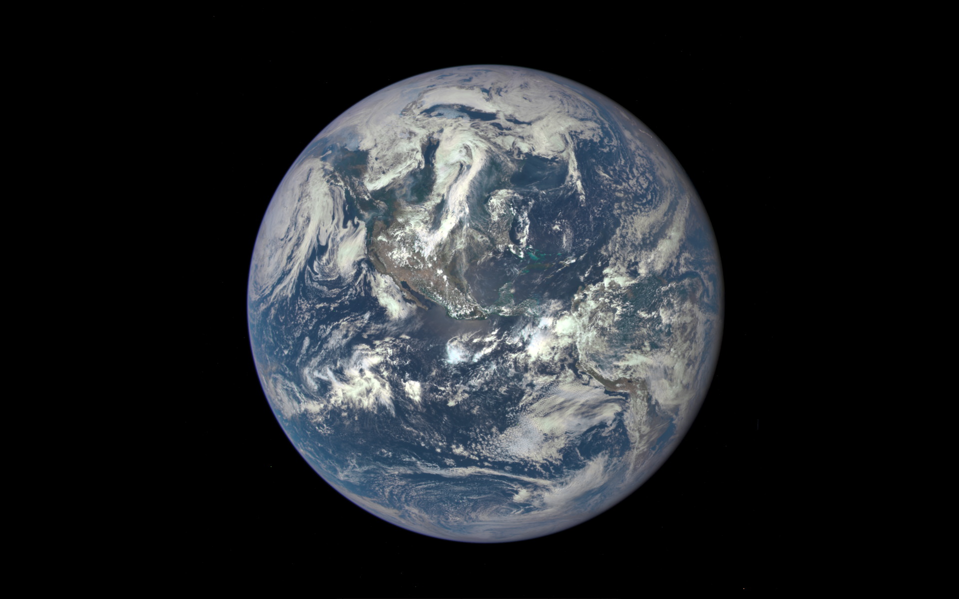
The U.S. government's Deep Space Climate Observatory (DSCOVR) satellite captured its first view of the entire sunlit side of Earth from one million miles away on July 6, 2015. (Image credit: NASA)
Privacy, security and trust
Recently, the Organization for Economic Co-operation and Development (OECD), a group based in Paris, published a report on the expanding access to satellite Earth-observation data, spotlighting what it means for privacy, security and trust.
"Advances in optical systems, photonics, cloud computing and artificial intelligence [AI] have democratized both the quality and accessibility of satellite data. However, this convergence of technologies also carries risks, including for national security and privacy," states the report, which was authored by the OECD's Marit Undseth and Claire Jolly.
Broadening access to advanced satellite data also creates new challenges, states the report, such as one of the key characteristics of Earth observation — its dual-use nature. "The same satellites used to track illegal fishing can often also detect military troop movements," the authors write.
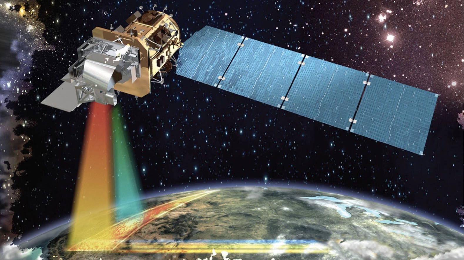
Illustration of a USGS-NASA Landsat remote-sensing satellite studying Earth. Government satellites the Landsat line were once the only craft doing such work. (Image credit: NASA)
New concerns
The OCED report notes that Earth-observation data and the technological convergence with artificial intelligence raise new concerns about national security, privacy and the ethical use of these data.
In fact, the report points to the growing hazard of fake or incorrectly used satellite imagery. "As part of the growing trend of digital disinformation, the trust in satellite data can be eroded by fake, misinterpreted or intentionally misrepresented imagery," it states.
Space.com asked leading remote-sensing specialists what's being done, what's being learned and what we should worry about.
Sovereignty and cost efficiency
Viktor Stoyanov is the chief operating officer of Smart Solutions at Space42, where he oversees the business unit's operational and financial performance.
Space42 is a United Arab Emirates-based space technology company that integrates satellite communications, geospatial analytics and AI capabilities. The group runs the Foresight Earth Observation constellation of synthetic aperture radar (SAR) satellites.
Space.com asked Stoyanov about the growing international use of remote-sensing data.
"Governments increasingly expect Earth-observation systems to deliver both sovereignty and cost efficiency, two goals that were long seen as mutually exclusive, as sovereignty typically meant heavy in-country investment in duplicative research and development and capital infrastructure," he responded.
Dual use
Stoyanov said Space42's focus is to combine those two outcomes.
"We believe that can only be achieved through international cooperation. Our Foresight constellation reflects this model, as the first sovereign dual-use synthetic aperture radar constellation in the region," Stoyanov said.
The satellites were manufactured in partnership with ICEYE in Finland, with critical integration and testing completed in the organization's facility in Abu Dhabi.
"The Abu Dhabi facility was built in cost-cautious and scalable manner, so that it can satisfy current sovereignty requirements commensurate with the constellation size, with the ability to expand the facility and meet demand of future programs," Stoyanov said.
Through cloud, dust and darkness
What new in-orbit technologies are being applied to Earth observation?
"The biggest shift in recent years has been the move from few, large, general-purpose platforms to constellations of small, specialized satellites and synthetic aperture radar," said Stoyanov.
"SAR satellites image through cloud, dust and darkness, which matters enormously for our region and for any customer who needs consistency regardless of timing and weather," he added.
Looking ahead, Stoyanov said that the short lifespan of satellites in low Earth orbit is an opportunity to ensure that each replenishment cycle becomes an upgrade cycle.
"As we plan to maintain and expand our fleet, we will continuously seek to deploy technical improvements across various performance metrics of the system — resolution, latency, satellite life, for example," said Stoyanov.
Artificial intelligence
A SAR constellation generates far more imagery than analysts can review manually within the allocated time, Stoyanov said. So the value lies in what can be extracted from it, not in the pixels themselves.
AI is therefore becoming increasingly important as a sorting tool for remote-sensing data, Stoyanov said. It is now the only practical way to work, for three reasons: volume, speed and accuracy.
Customers responding to a flood, a maritime incident or a supply-chain disruption need an answer in minutes, not a report next week — "decision-grade intelligence within minutes," explained Stoyanov.
On the topic of accuracy, while trained analysts are excellent at interpretation and large-object classification — like buildings and sea vessels — there are changes that the eye can easily miss. "Algorithms comparing each new pass against the historical baseline — they catch those consistently, without fatigue," said Stoyanov.
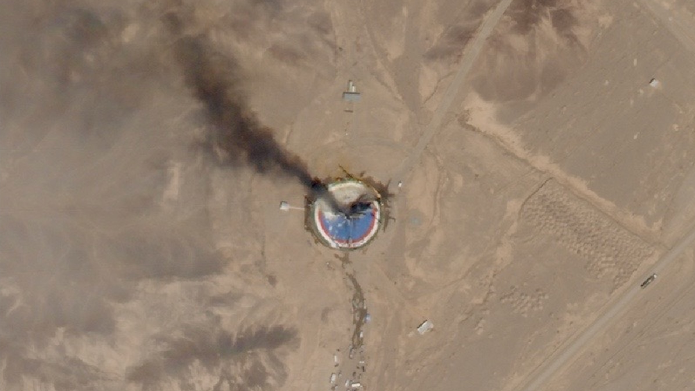
A SkySat Earth-observation satellite operated by the California company Planet spotted the wreckage of a failed launch out of Iran's Imam Khomeini Space Center on Aug. 29, 2019. (Image credit: Planet Labs, Inc.)
Hybrid model
Francis Doumet is the CEO and co-founder of Metaspectral, a company based in Vancouver, British Columbia, that builds AI technology to rapidly analyze hyperspectral imagery.
Doumet views collaboration between different national space agencies as "extensive and, somewhat uniquely, very open." Missions are frequently carried out through "shared funding, instruments, expertise and ground infrastructure," he said, with the resulting scientific data made available internationally.
Commercial imagery is less openly distributed because it is commercially licensed and may have security implications, Doumet said, but it is increasingly enabling international cooperation in the defense sector.
For example, the U.S. Space Force's Tactical Surveillance, Reconnaissance and Tracking (TacSRT) program combines commercial satellite imagery and analytics from American companies and allied nations to rapidly respond to operational requests, Doumet said.
"This has shaped the Earth-observation sector into a hybrid model," said Doumet. Governments and allies share requirements and intelligence, he explained, while commercial operators supply imagery and analytics "at a speed and scale that would be difficult or impossible for a single nation to produce alone."
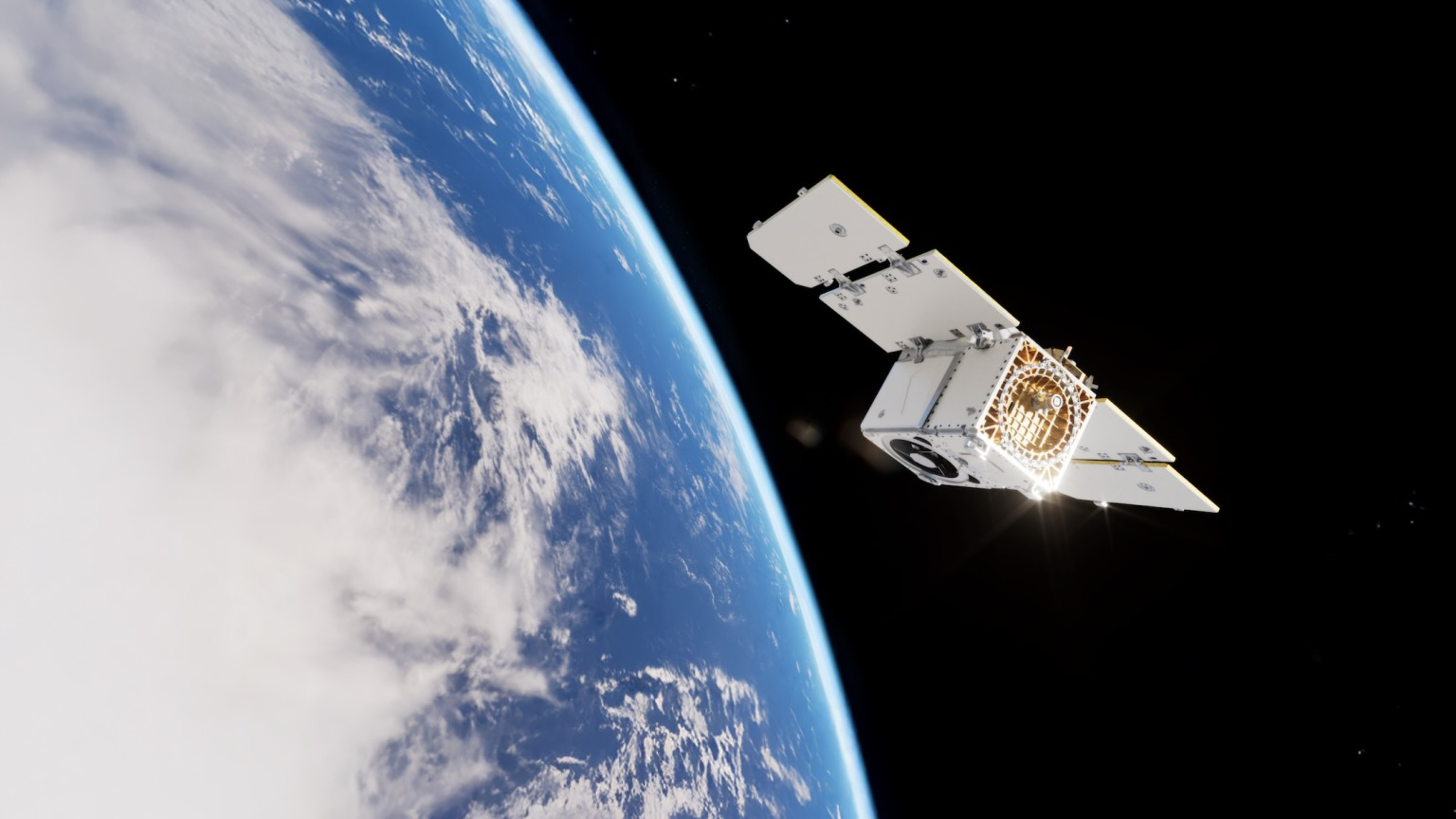
Artist's illustration of Planet's Pelican-2 Earth-observing satellite in orbit. (Image credit: Planet Labs PBC)
Hyperspectral sensors
The improvement in the spatial resolution of hyperspectral sensors is an important advance in Earth observation, Doumet pointed out.
Better sensors, high-speed compression and improved communications, such as optical links, are now narrowing a "resolution gap." Onboard AI is equally transformative, he added.
"Satellites can analyze imagery in real time, identify relevant signatures and transmit alerts or compact intelligence products instead of waiting to download an entire hyperspectral data cube," Doumet explained.
Spectral fingerprints
Angie Crews is a principal research associate with the University of Colorado, Boulder's Center for National Security Initiatives.
"There has been a tremendous growth in the commercial remote-sensing industry," Crews told Space.com, noting that this field had previously been government-based. "It's now possible for these commercial companies to deploy entire constellations of Earth-observing satellites, which fundamentally changes the architecture in place."
Crews pointed to the hyperspectral nature of Earth remote sensing — taking the "spectral fingerprints" of what's occurring on Earth.
"It's impressive how the industry is moving forward with some of these capabilities," she said.
Balancing act
"There are some tremendous benefits as well as some things that we need to think about" when it comes to the new direction that Earth observation is taking, Crews said. Remote-sensing data can be inherently dual use, she added.
"Overall, I think we're seeing some enormous benefits from our increasingly capable commercial remote-sensing systems. But it does raise some security and governance questions," said Crews.
It's a balancing act to manage, according to Crews. How best to secure the information for national security purposes versus not putting the squeeze on innovation exhibited by the private Earth-observation firms?
Meaningful information
Shifting to her teaching role at the University of Colorado, Boulder, Crews told Space.com that one of the things that's especially important is to train students in the remote-sensing field to think beyond any single sensor or dataset.
"The next generation needs to understand how different sensing technologies work and also how to work with very large datasets and extract meaningful information using AI and machine learning," Crews said.
"We also need to train the students on critical thinking and ensure they are aware of the limitations of AI. The underlying physics need to be understood and the results need to be validated so that the students use and interpret the results appropriately," she concluded.