US Space Force says it operates weapons in orbit: ‘Our aim is deterrence’

The U.S. Space Force is opening up about its operation of orbital weapons, but not much beyond admitting that they exist.

During a "State of the Space Force" address at the Air & Space Forces Association’s Air, Space & Cyber Conference in National Harbor, Maryland, on Tuesday (Sept. 15), Chief of Space Operations Gen. Douglas Schiess stated unequivocally that the Space Force uses active space-based weaponry to support United States national defense.

“Let me be crystal clear: Today, Guardians operate on-orbit weapons that can defend the joint force against space-enabled attacks,” Schiess said, referring to the official name for Space Force personnel.

Space is central to national security infrastructure and warfighting efforts, and serves a critical role in how the military communicates, navigates, conducts operations and tracks threats globally. It’s become an increasingly contested domain, with adversaries developing technologies designed to disrupt or destroy satellites in orbit as well as hypersonic weapons that challenge ground-based-only defenses.

Schiess didn’t specify what kind of weapons the U.S. operates in orbit, how many there are, or what exactly they do. But the revelation that the Space Force is operating those kinds of assets is by itself a pretty hefty admission. The news expands the known scope of U.S. military activity in the final frontier, which already included the use of satellites for GPS, communications, missile warnings and other targeting and intelligence operations.

“Space is both a battlefield and the backbone of our joint force,” Schiess said. “We face determined and credible adversaries who are building counter-space systems at incredible speeds to target directly the United States’ space advantage.”

The chief adversaries are China and Russia, experts have said. Both nations have developed a range of counterspace capabilities intended to threaten or interfere with other satellites, including through electronic warfare and anti-satellite (ASAT) systems. Russia demonstrated as much in 2021, when it destroyed one of its own spacecraft with an ASAT missile, which created a cloud of more than 1,500 pieces of orbital debris.

The U.S. has been rapidly expanding its own military presence in orbit over the past decade or so, and is ramping up those efforts even more with plans for the implementation of President Trump’s Golden Dome missile interception system. In the last year alone, the Space Force has awarded more than $12 billion in major contracts to companies like SpaceX, Rocket Lab, L3Harris and Boeing for a wide range of services, including national security launches, space-based tracking satellites and other defense technologies.

Schiess pointed to the Victus Haze mission as an example of how the Space Force is getting ready to react to orbital threats on short notice. Rocket Lab carried out Victus Haze in June, launching an Electron rocket and interceptor spacecraft within just 17 hours of receiving notice from the Space Force, setting a launch turnaround record.
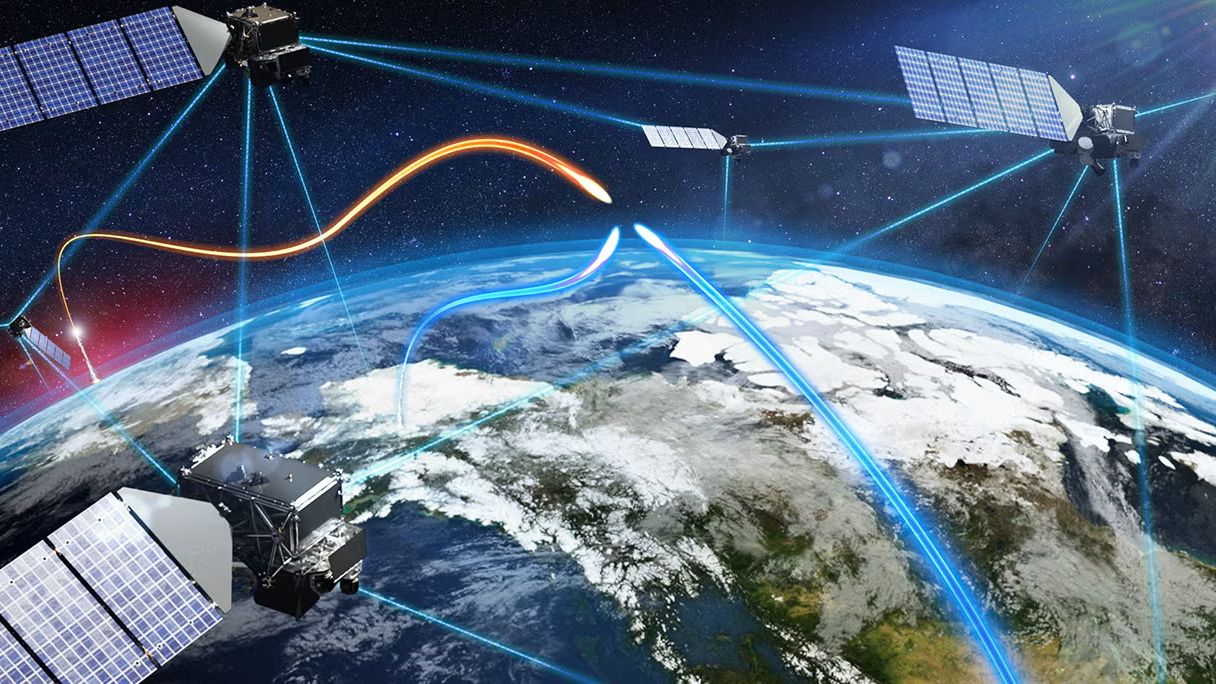
a constellation of satellites shoots beams to each other and down to Earth.

Illustration of part of a Golden Dome satellite constellation. (Image credit: L3Harris)

Schiess also highlighted the Space Force’s critical role in Operation Epic Fury and the ongoing engagement of U.S. military forces in Iran. “Guardians are not supporting from the sidelines as a nice-to-have, but we are delivering space power directly into the fight as a need-to-have,” he said. Schiess even gave an anecdotal example of the actions of one Guardian, “Specialist Gray,” in the heat of battle.

“Even as alarm red sirens were blaring and incoming missiles targeted her site, she courageously held the line, protecting forces, denying adversary capability, and delivering space effects until her commander had to literally pull her from the console to safety,” Schiess said.

Schiess described her operations before she was pulled from that console, giving some clue as to what exactly is meant by “on-orbit weapons.”

He said the Guardian in question needed to “reconfigure her weapon system and execute critical non-kinetic fires,” and went on to add, “She locked onto the target, optimized her weapon system and waged electromagnetic warfare against a determined adversary.”

Those descriptions offer at least some clues about the technologies involved. Phrases like “electromagnetic warfare” and “non-kinetic” could point to signal jamming technology or other non-physical means of disrupting a target.

Schiess said the Space Force intends to continue expanding its combat power with more robust architectures and the ability to respond with increasing speed to evolving threats. That proliferation on behalf of Golden Dome and other national security programs stands to deliver substantially more military hardware into orbit in the coming years, but Schiess framed the buildup around the prevention of conflict, rather than its provocation.

“Our aim is deterrence,” he said.
‘The violence leaves a mark’: How satellites are helping the world monitor war and atrocities

For decades, researchers have been monitoring armed conflict around the world by analyzing news reports and collecting oral testimonies. This approach, while valuable, has its limitations. A new study suggests that a satellite's view from above might fill the gaps in our understanding of the grim realities of war.

In 2017, the Myanmar Army murdered several hundred Muslim Rohingya civilians in the village of Chut Pyin near the country's western coast. Reports of the massacre in the settlement of about 2,000 reached the world through the testimonies of survivors who fled to neighboring Bangladesh. The massacre was part of a years-long campaign of brutality against the Muslim minority conducted by the Buddhist-run state. Satellite data later showed that houses in the predominantly Rohingya neighborhood were burned down by the Myanmar military during the atrocity, providing undeniable proof that the ethnic minority was targeted.

The incident is one of many demonstrating the advantage of adding views from space into conflict research, study lead author Valerie Sticher, a political science researcher at the University of Zurich in Switzerland, told Space.com.

"We have huge data sets about wars around the world going back 40 years," Sticher said. "But those datasets are based mostly on media reports. And these reports are not always available and not always reliable. Media can have biases and often focus only on certain types of violence."

For example, human reporters are more likely to focus on the numbers of people killed rather than the number of houses destroyed, she said. Satellites, on the other hand, provide a broad sweep over vast areas of land and, crucially, revisit the same location repeatedly. They can reveal patterns in conflicts and trends that could otherwise go undetected, while providing an overview of areas controlled by authoritarian regimes.

The researchers are now developing a methodology to integrate satellite observations into conflict research and create automated image analysis pipelines that would generate early warnings and alert the world to what's happening on the ground.

"Automated satellite data analysis would allow us to respond faster," said Sticher. "For example, in Myanmar, the area affected by ethnic cleansing was closed to independent journalists and investigators. Satellite data was the earliest reliable information to reach the outside world."

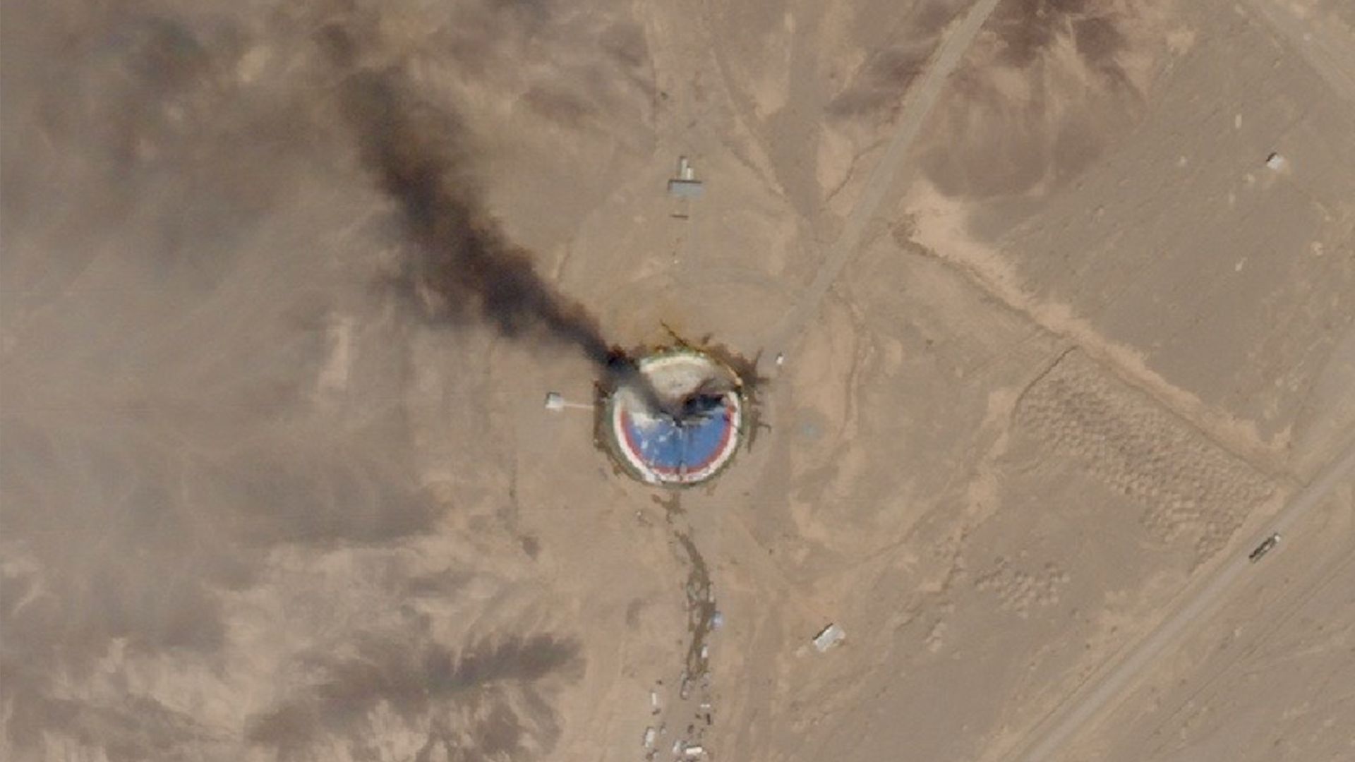
satellite photo of a circular, blue launch pad in the desert with black smoke rising from it

A SkySat Earth-observation satellite operated by the California company Planet spotted the wreckage of a failed launch out of Iran's Imam Khomeini Space Center on Aug. 29, 2019. (Image credit: Planet Labs, Inc.)

Hannes Mueller, a conflict researcher at the Spanish National Research Council, said that totalitarian governments can be very good at preventing information about atrocities from reaching the world. However, they can hardly fool satellites.

"In Myanmar, for example, when the military clears villages, they frequently kill everybody in those villages," he said. "Then you don't have any eyewitnesses for you to find out what's going on. But they usually also destroy the entire village, and so the violence leaves a mark from space."

Mueller was not involved in the new study but has used satellites in his work since the conflict in Syria in the early 2010s. He lauds the new paper for trying to "plot the road" for a more systematic integration of satellite data into conflict-monitoring data sets.

"Imagine we could generate a data stack of the entire world of all housing destruction since 2020 without any gaps in it," he said. "That would be a complete breakthrough!"

But satellites, too, have their limitations, he said. Currently, spacecraft must be tasked to take images and beam them to Earth. Because of the limited download availability, they can't image every spot they fly over, meaning they usually only reveal the aftermath of catastrophic incidents. For example, the Syrian city of Homs only became the focus of satellite imaging campaigns after the Syrian military attacked it with heavy artillery to suppress pro-democracy protests.

"There are no images of Homs before it got attacked," said Mueller. "There is no archival data of the city from before. Then, after the attack, you suddenly get lots."

In the future, onboard AI image processing — which some of the commercial satellite Earth-observation companies have already rolled out — might solve the problem. Machine learning algorithms running on computers on board the satellites will be able to detect incidents of potential interest and autonomously select significant images to send to the ground.

But there are other concerns. Just as authoritarian regimes can deny access to warzones to independent journalists, governments can order Earth-observation companies to restrict access to images of specific areas. In fact, the U.S. government did just that earlier this year when it ordered American commercial Earth-observation providers like Planet Labs to stop releasing high-resolution images of the Gulf of Oman and the Strait of Hormuz amid the escalating conflict in the region. The U.S also asked Europe to delay releasing images of that region captured by the European Sentinel satellites by 24 hours.

"With that, we are back to the same biases that we have with the news reporting," Mueller said. "We need to think about infrastructure that would provide us with transparency. That would really be a revolution in conflict research."

The new study was published in the journal Nature on Sept. 9.

2 private spacecraft zoom within 650 feet of each other to showcase ‘advanced capabilities’ in orbit (photos)

A pair of private spacecraft just showed off some impressive maneuverability high above Earth.

The two probes — Mira satellites operated by the California startup Impulse Space — zoomed within 650 feet (200 meters) of each other in low Earth orbit (LEO) recently. The rendezvous demonstrated skills that could be useful to a variety of customers down the road, according to the company.

"These types of dynamic, agile maneuvers are how we unlock full access to space after launch and create new mission possibilities," Tom Mueller, CEO and founder of Impulse Space (and, prior to that, the first person Elon Musk ever hired at SpaceX), said in a statement on Tuesday (Sept. 8). "Our teams that design, build and operate Mira are leading the way toward a true space age, and customers across all sectors will be the beneficiaries."

photo of a cube-shaped satellite in deep space, taken from a distance by another satellite

The LEO-3 Mira vehicle, taken from a distance of approximately 700 meters (2,300 feet) by a camera onboard LEO-2. (Image credit: Starfish Space/Impulse Space)

Mira is an orbital transfer vehicle — a spacecraft designed to deliver customer payloads to precise locations in Earth orbit or beyond. The dishwasher-sized Mira can carry up to 660 pounds (300 kilograms) of gear and is highly maneuverable, as the recent rendezvous showed.

The operation involved Mira satellites that launched in January 2025 and November 2025, on missions that Impulse calls LEO Express 2 (LEO-2) and LEO Express 3 (LEO-3), respectively.

a white cube on a black background

Impulse Space's LEO-2 Mira vehicle, as seen from a telescope onboard LEO-3 from a distance of approximately 5,000 meters (16,400 feet). (Image credit: HEO/Impulse Space)

The action began this past February, when the LEO-2 Mira conducted a lengthy engine burn to close in on its counterpart. LEO-2 performed additional, smaller burns throughout the spring and summer, coming into orbital alignment with LEO-3.

"Then in July, LEO-2 executed a series of close approaches to LEO-3, starting at about 820 meters [2,690 feet] apart and subsequently moving closer to LEO-3," Impulse Space wrote in the Tuesday update. "Ultimately, for the closest approach, LEO-2 maneuvered to within about 200 meters of LEO-3."

Both Miras chronicled the rendezvous, snapping photos of each other with onboard camera gear. Two other companies, Starfish Space and HEO, worked with Impulse Space to pull off this orbital photo shoot.

Impulse has worked with Starfish before. The duo collaborated late last year on a rendezvous between LEO-2 and the first space-flown Mira, which launched on the Leo Express 1 mission in November 2023.

On that operation, called Remora, LEO 2 used Starfish Space navigation software to get within 4,100 feet (1,250 m) of LEO 1.

"We're showcasing some of the advanced capabilities that set Mira apart from other vehicles," Drew Damon, vice president of spacecraft programs at Impulse, said in Tuesday's statement. "Twice now, we've demonstrated that Mira has the agility and propulsion to support a new class of dynamic operations on orbit, and our team is excited to continue tackling the mission sets Mira is uniquely qualified to handle."

Impulse is not alone in developing and demonstrating orbital maneuverability. Such skills are a key priority of national governments, which want to service and upgrade their own satellites — and keep tabs on the activities of adversary craft. For example, earlier this year, two Russian spacecraft got within a mere 10 feet (3 m) of each other high above Earth.

US military practices orbital dogfighting in 1st-ever ‘live fly’ exercise in space

United States Space Command just held its first-ever "Apollo Maneuvers" exercise, which saw spacecraft maneuvering through simulated contested environments.

U.S. Space Command combines assets and personnel from each U.S. military branch (including the U.S. Space Force) to project American military power into and from orbit. It's unclear which or how many satellites or spacecraft took place in Space Command's recent Apollo Maneuvers 2026, but the exercise involved international partners, according to a command statement. What is known is that the exercise aimed to demonstrate "dynamic on-orbit operations, validate contested logistics and advance collective space maneuver doctrine."

To put it in plain English, this means that Space Command practiced maneuvering satellites and other spacecraft in proximity to one another in a simulated conflict environment, in order to continue refining the "orbital dogfighting" that the U.S. military has been hinting at for some years.

In military terms, dogfighting refers to the close aerial combat that fighter jets engage in, pitting two or more pilots against one another in contests of flying ability and firepower.

In terms of space, this involves "objects in space maneuvering in and out and around each other in synchronicity, and in control," according to Space Force's Vice Chief of Space Operations Gen. Michael A. Guetlein.

“That's what we call dogfighting in space," Guetlein told attendees at a conference in 2025, according to Air & Space Forces, while speaking about Chinese satellite operations observed in 2024.

From statements that U.S. Space Command leadership gave about its recent exercise, it sounds like Apollo Maneuvers practiced just that, but in space.

"We will take some of our existing satellites and work with partners to demonstrate what are some of the requirements and capabilities to be able to maneuver for advantage, not just maneuver when you have to change your orbital position," Space Force Gen. Stephen N. Whiting, commander of U.S. Space Command, told reporters last month during a briefing at Redstone Arsenal in Alabama, according to Air & Space Forces.

"The side that can maneuver persistently and at scale will set the operational rhythm in orbit."

a man in a black military dress uniform speaks on a stage in front of an image of earth seen from space

Space Force Gen. Stephen N. Whiting, commander of U.S. Space Command, delivers a keynote address at the Space Foundation's 40th annual Space Symposium in Colorado Springs, Colorado on April 8, 2025. (Image credit: Space Foundation)

When it comes to space and what appears to be the inevitability of a conflict extending to Earth orbit, we're still not quite sure what that will look like. But several nations have been developing capabilities and concepts for maneuvering satellites in close proximity to other satellites with the intent to destroy or disable them, or to deny or degrade their communications or intelligence-gathering capabilities.

The U.S. Space Force, in particular, has been developing an operations framework for fighting a war in space and has held multiple training exercises aimed at practicing "orbital warfare."

But Space Force and U.S. Space Command still appear to lack many of the technologies they say they need to wage such warfare. Speaking at the Space Foundation's Space Symposium in 2025, Whiting stated that that the United States needs "orbital interceptors" to fight in space.

"And what do we call these?" Whiting rhetorically asked attendees. "We call these weapons, and we need them to deter a space conflict and to be successful if we end up in such a fight."

But U.S. Space Force has ordered and executed recent missions that have demonstrated capabilities and technologies along the lines of what Whiting described.

In June 2026, for example, a Rocket Lab Electron rocket sent one of the company's Puma satellites to orbit, where it rendezvoused with a True Anomaly Jackal spacecraft that launched a month earlier. Once both spacecraft were in orbit, they maneuvered close to one another to simulate "dynamic engagements."

The mission showed Space Force's "readiness to lean on our commercial partners to deny, disrupt and counter any adversarial advantage — no matter where they try to operate in space," according to a Space Force statement.

2 satellites just burned up in Earth’s atmosphere — and scientists were watching from a private jet. Here’s why

A team of researchers just chased a pair of reentering satellites in a private jet to learn about the pollution caused by space debris burning up in Earth's atmosphere.

The satellites in question were the European Space Agency's (ESA) Tango and Samba spacecraft, which once formed the Cluster constellation, together with the already de-orbited Rumba and Salsa. The quartet used to study the interaction of Earth's magnetic field with the solar wind. After 25 years of service, ESA took advantage of the Tango and Samba's controlled demise to help scientists learn what happens when satellites break apart and burn up during their spiral back to Earth.

The international team of researchers chased the two reentries, which occurred one day apart — on Aug. 31 and Sept. 1 — above the southern Pacific Ocean a few hundred miles from the Polynesian archipelago of Tonga.

Their goal was to understand what happens when satellites disintegrate and what chemical compounds arise in the process. Although companies such as SpaceX, Amazon and Blue Origin want to launch huge numbers of satellites to space in the next decade — SpaceX alone plans to loft 100,000 of its Starlink V3 spacecraft — very little is known about the effects of satellite reentries on Earth's atmosphere. Researchers are also still unsure which spacecraft burn up completely and how many fragments may reach the ground, putting lives and property at risk.

"We want to understand what happens to these bodies as they fly through the atmosphere, which causes friction and very high temperatures," Jiří Šilha, CEO of the Slovak company Astros Solutions, and one of the researchers aboard the plane, told Space.com. "We know that those satellites break up into fragments, which subsequently melt in the atmosphere."

The researchers chased the reentering spacecraft following exact calculations provided by ESA controllers, who were able to maintain connection with the spacecraft until the very last moment before they plunged into the atmosphere.

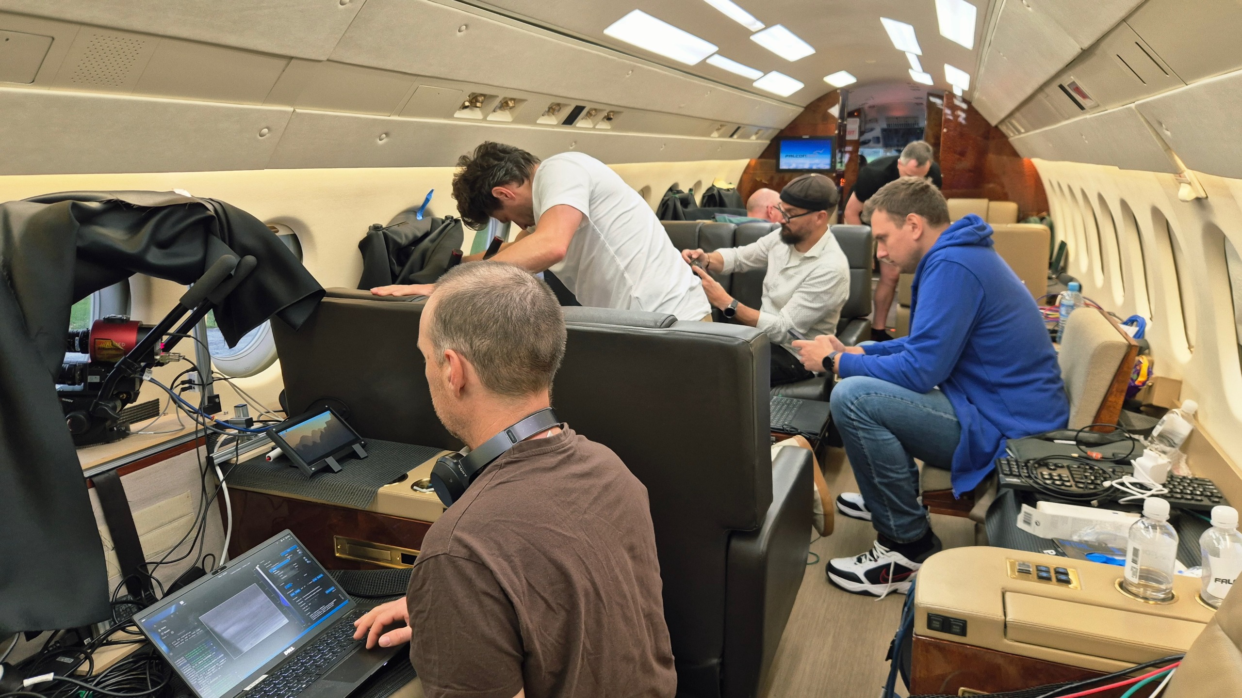
six people inside a private jet, with computer equipment strewn around the cabin

Researchers inside a private jet during a campaign observing the reentry of ESA's Cluster Tango satellite on Sept. 1, 2026. (Image credit: Jiří Šilha)

The satellite reentries, although they occurred during daylight, were visible from aboard the plane even to the naked eye, said Šilha, and created spectacular fireballs that lasted tens of seconds.

"Bolides and meteors only last a few seconds or less," said Šilha. "But satellites are slower. They enter the atmosphere at a shallower angle, and the atmosphere slows them down further."

But the researchers were there for science, not for a sky show. And it was a rare opportunity: The Cluster trajectories were so precisely known that the scientists could prepare for them and be at the exact spot at the exact time to witness those explosions from only a couple of hundred miles away.

The aircraft, a small commercial business jet, was packed with 30 cameras and spectrometers fitted with special filters to capture not only how the satellites disintegrated but also detect the spectral signatures of the chemical elements released as their bodies burned up.

Eight scientists were squashed on board the darkened jet operating the instruments through the aircraft's six windows as the pilots navigated to the vicinity of the spot where ESA analysts had predicted the breakup would occur.

"We were flying toward the object, and first it looked like a compact source of light as the material ablated," said Šilha. "At some point, there was a sudden explosion as the satellite disintegrated."

The plane allowed the researchers to overcome any clouds that could obscure the view from the ground, and also to bypass the thickest layer of the atmosphere, which would distort the measurements. As the satellites hurtled through the air, slowing down from the mind-boggling speed of 22,370 mph (36,000 kph) at which they hit the upper atmosphere, the jet approached them to within a distance of around 75 miles (120 kilometers).

"We begin observing it when it's at about 90 kilometers [56 miles] and it stops being visible at about 65 to 70 kilometers [40 to 44 miles]," Šilha said. "For about thirty to forty seconds after the explosion, you can observe an interesting structure as all those various fragments ablate in the atmosphere. Then they all either burn up or slow down."

Šilha said the cameras captured tens of fragments, in detail that had never been observed before.

The researchers also attempted to trace seven chemical compounds, including titanium, sodium and potassium, which get released as satellites burn up. The team was especially interested in aluminum, which makes up the majority of a satellite body. Aluminum is not naturally present in Earth's atmosphere and most likely forms aluminum oxide during the incineration. The potential presence of aluminum oxide in the atmosphere in higher concentrations worries scientists, as it could potentially trigger ozone depletion in the stratosphere.

"We tried to measure the aluminum at different altitudes, using specialized filters, which could tell us when this aluminum interacts with the atmosphere," said Šilha. "That's when the aluminum oxide likely forms, and that's something that has never been observed before. We don't know exactly how and in what quantities the aluminum oxide might be forming."

The researchers will now analyze the data to learn exactly what chemical reactions may be occurring during every second of the breakup and burn-up process. The data will help atmospheric physics and chemistry researchers improve their models to further our understanding of the potential damage the growing satellite industry might do to the planet and its climate in the future.

"The data will help us validate whether the models agree with reality," said Šilha.

The team previously chased the reentry of the first of the four Cluster satellites — Salsa — in September 2024. The lessons from that campaign helped the team get closer to the Tango and Samba spacecraft and obtain more and more accurate data.

The Vela Incident: Did an American satellite detect a secret nuclear test in 1979?

It began with an unusual flash detected off the coast of South Africa by an aging American satellite — and to this day, debate continues over whether this odd Cold War event involved an illicit atmospheric nuclear test.

The strange story of the "South Atlantic Flash," better known as the Vela Incident, began on Sept. 22, 1979. At that time, Vela 6911, a satellite in a constellation developed by the United States for the specific purpose of detecting nuclear detonations, observed something that immediately alarmed officials: a peculiar flash of light emanating from somewhere over the South Atlantic Ocean.

A significant part of what concerned U.S. officials at the time had been the double flash of light detected during the event — a distinctive feature that strongly resembled the flashes produced by a nuclear explosion in Earth's atmosphere. The characteristic double flash results from the rapidly changing brightness of the fireball and shock wave produced by an atmospheric nuclear detonation, creating a distinctive optical signature that Vela's sensors were specifically designed to recognize. The South Atlantic event, therefore, seemed like a prime candidate for a secretive nuclear test being carried out by an unknown party — but if that were the case, who was responsible?

What do we know?

U.S. officials responded to a possible nuclear test

Then-President Jimmy Carter was promptly alerted to the situation, as evidenced in diaries the former U.S. leader would publish years later. "There was indication of a nuclear explosion in the region of South Africa," Carter wrote in an entry on the same date of the event. A later entry penned the following February would go on to add that "We have a growing belief among our scientists that the Israelis did indeed conduct a nuclear test explosion in the ocean near the southern end of Africa."

a man in a suit sits at a large wooden desk beside a globe

President Jimmy Carter, seated at a desk in the Oval Office of the White House in 1980. (Image credit: Bettmann/Getty Images)

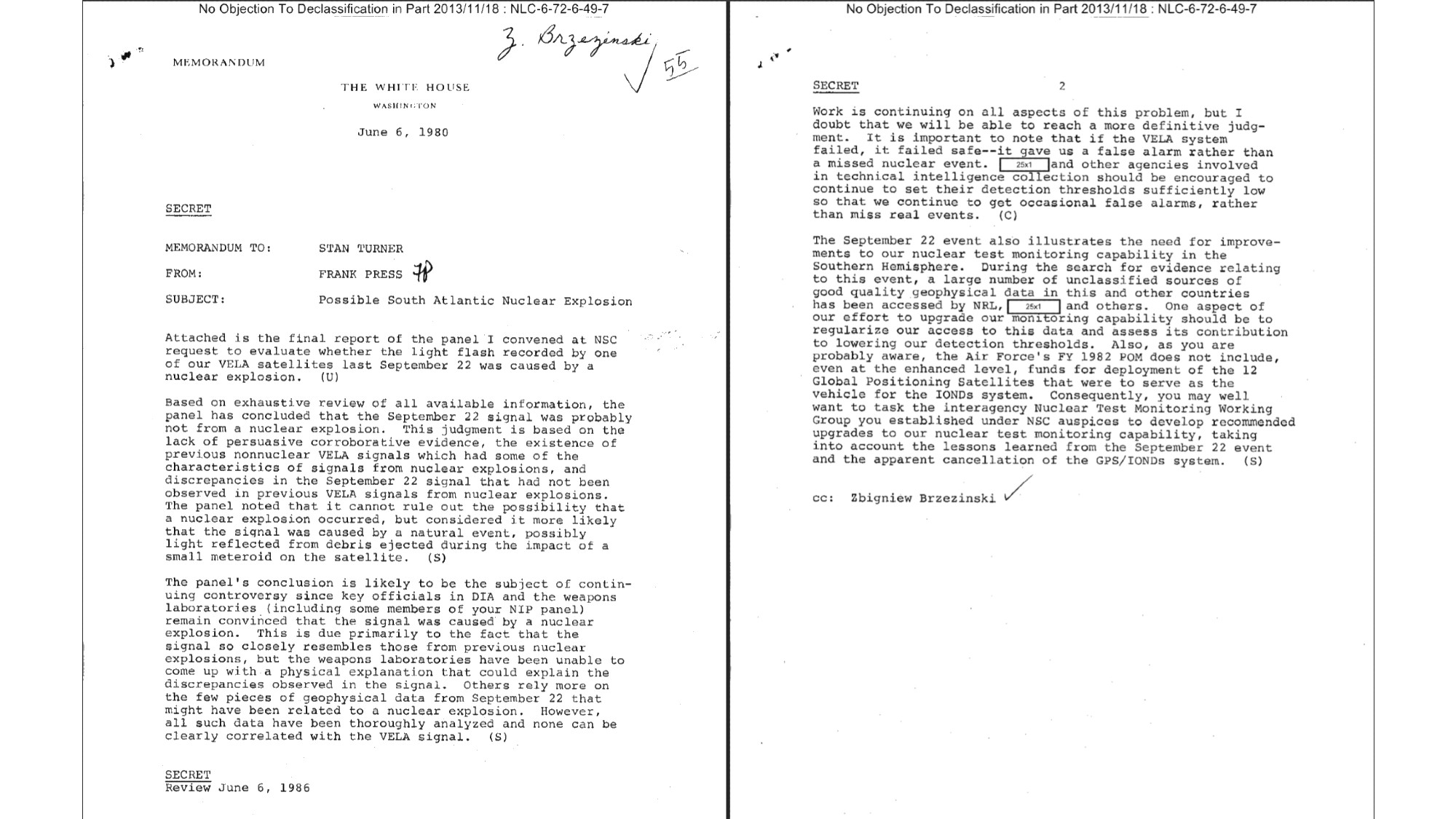
Despite that belief regarding the possibility of a clandestine nuclear test, a scientific panel assembled in 1980, chaired by MIT professor Jack Ruina, eventually put forward an alternative explanation: that the flash had more likely been an anomaly caused by a small meteoroid striking the satellite.

Notably, the panel did not rule out the possibility of a nuclear explosion at the time, although the alternative they put forward remained controversial among scientists and intelligence officials.

a memorandum on white house stationary

A memorandum to Director of Central Intelligence Stansfield Turner from Frank Press, White House science adviser, in which Press explains the reasoning behind the Ruina panel's conclusion that the Vela flash was "probably not from a nuclear explosion" and was therefore more likely "caused by a natural event." (Image credit: Public Domain/National Security Archive)

Documents and government insiders surface

By the turn of the 21st century, formerly classified documents began to surface that revealed the extent of the inner tensions between U.S. government agencies over what caused the Vela incident.

Among the critics of the debris-induced "anomaly" hypothesis had been Defense Intelligence Agency Vice Director Jack Varona. According to documents released in 2006, Varona said the investigations by the 1980 scientific panel had been a politically motivated "whitewash," and that evidence collected by the U.S. intelligence community included detections "unique to nuclear shots in a maritime environment," based on an analysis by the Naval Research Laboratory.

Varona wasn't alone. Other former intelligence officials who came forward over the years included Stansfield Turner, the former Director of Central Intelligence during the Carter administration, who in 2003 described the Vela detection as a "man-made phenomenon."

Similar views were advanced by retired CIA officer Tyler Drumheller, who in 2006 wrote that he had sources at the time who "collectively provided incontrovertible evidence that the [South African] apartheid government had in fact tested a nuclear bomb in the South Atlantic in 1979, and that they had developed a delivery system with assistance from the Israelis."

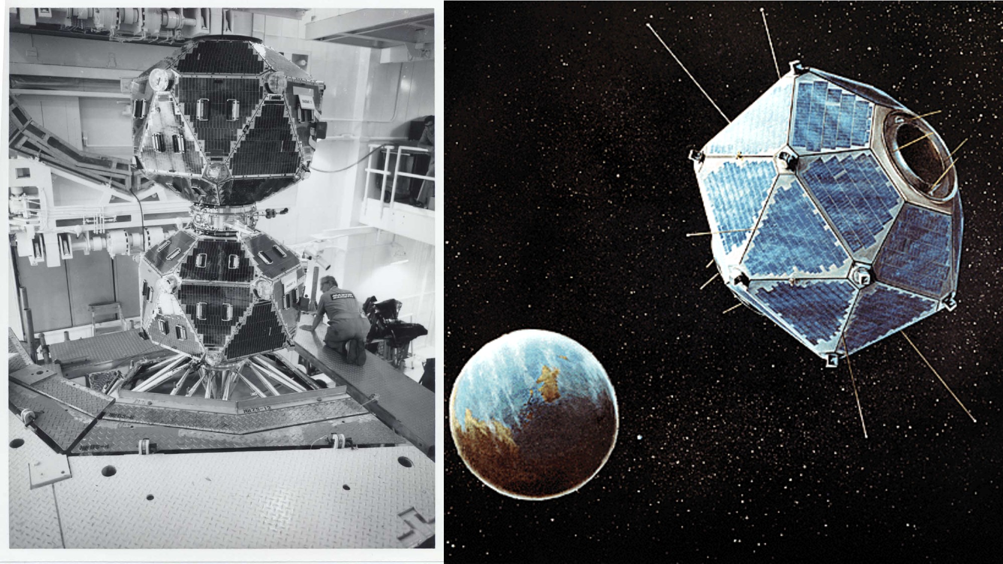
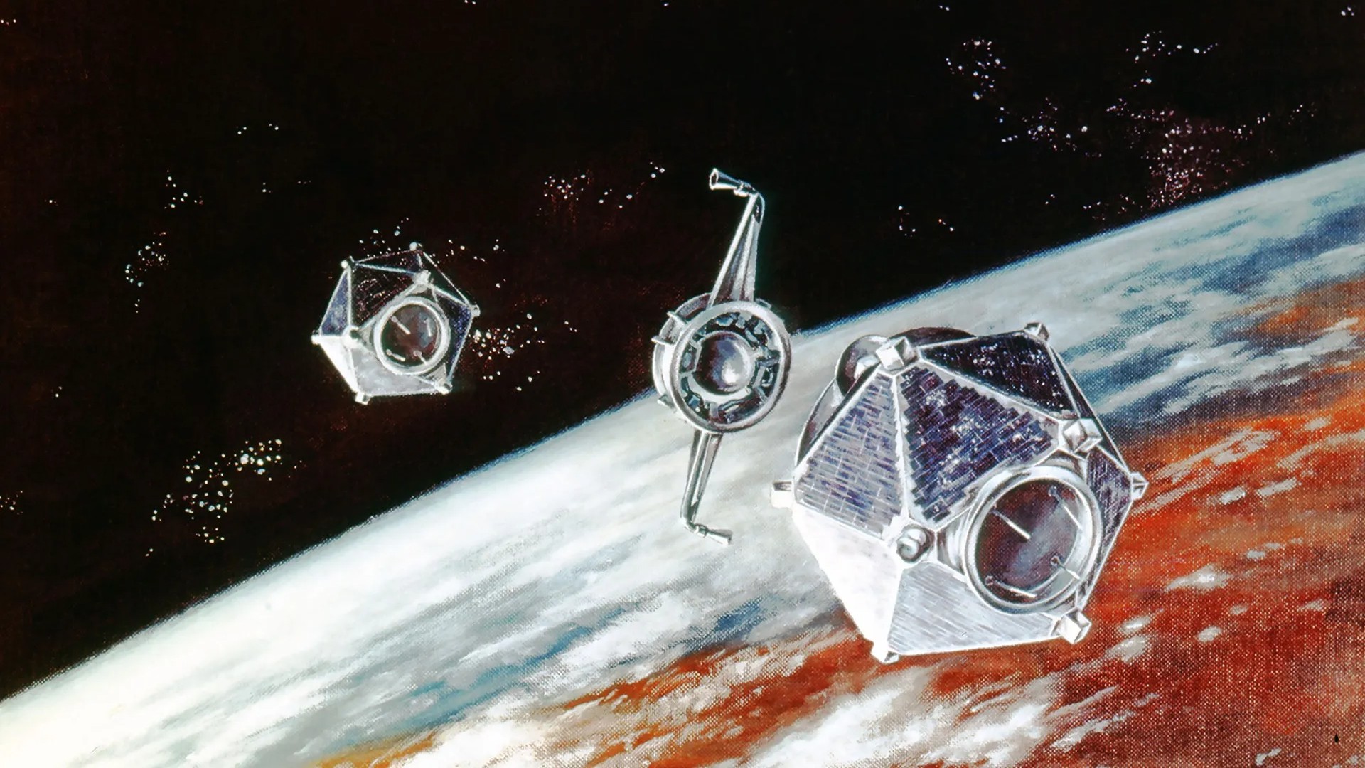
a dodecahedron-shaped satellite in a clean room; and an illustration of the same satellite in orbit above earth

The Vela-5A & B satellites in a cleanroom at Los Alamos National Laboratory (left); and an illustration of one of the satellites in orbit above Earth (right). (Image credit: Los Alamos National Laboratory)

What remains unknown?

Scientists revisit the mystery

While we still don't know if the South Atlantic Flash was a nuclear test, several scientists have reexamined the available evidence within the last decade, and what they found has lent further weight to the idea that the Vela incident had involved a detonation of some kind.

Among the most significant assessments, a 2017 study by Christopher Wright and Lars-Erik De Geer combined modern research into interplanetary dust and hypervelocity impacts with revelations from recently declassified documents, as well as publicly available information that had been previously overlooked.

Their conclusion: while no model was presented for the tenuous "meteoroid" theory advanced by the May 1980 scientific panel, the double flash observed by the Vela satellite in 1979 was indeed "consistent with a nuclear explosion, albeit detected by an aged satellite for which background modulation was abnormal and/or commenced earlier," adding that additional radionuclide and hydroacoustic evidence existed which supported the conclusion "that the Vela Incident was a nuclear weapon test explosion."

Wright and De Geer weren't alone either. A 2022 study examined data collected by NASA's Nimbus-7 satellite just 16 minutes and 44 seconds after the double flash over the South Atlantic, which suggested a disturbance in the ozone layer that appeared to be consistent with a blast-generated shock wave.

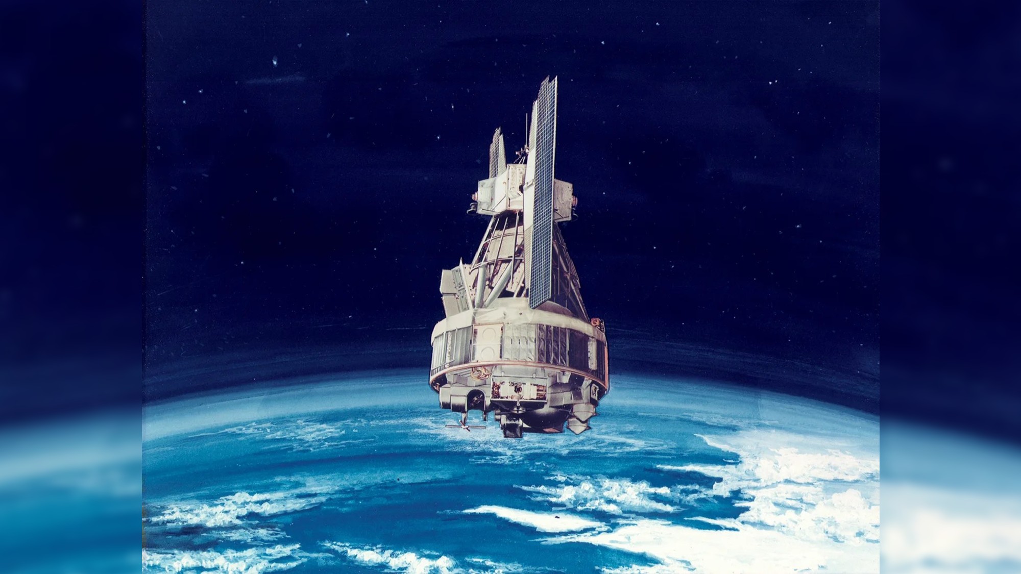
an illustration of a hexagonal satellite with two wing-like solar panels in orbit above earth

Artist's concept of a Nimbus spacecraft in orbit over Earth. (Image credit: NASA)

Still, some of the original members of the 1980 scientific panel have defended its work amid the more recent scientific studies. Richard Mueller, who served as the panel's youngest member at the time, defended the group's conclusions in a November 2019 oral history conference, maintaining that the chances the Vela incident had involved a nuclear event were "as close to zero as it gets."

This determination, Mueller argued, was made despite early interpretations by many panelists that a nuclear event had seemed most likely. Wright and De Geer, both of whom attended the 2019 oral history conference, were among the participants that pushed back on Mueller's views.

Who was responsible?

Amid the mounting evidence over the last several decades suggesting the Vela incident was indeed a nuclear test, debate continues over who was most likely to have been responsible.

Although suspicions have long centered on a cooperative — and secret — strategic effort between apartheid-era South Africa and Israel, publicly available evidence remains lacking, and a fair amount of information in declassified documents that could point to this possibility remains redacted.

a dodecahedron-shaped satellite in orbit above earth

An illustration of two Vela satellites separating in orbit. (Image credit: Los Alamos National Laboratory)

The mystery remains

Thus, after more than four decades, questions continue to linger over the famous Vela incident, including what nations might have been involved in such a test if it occurred. Despite that uncertainty, one thing does seem evident: information conveyed in unredacted portions of declassified records, combined with modern scientific analyses, increasingly point to the likelihood that the strange "South Atlantic Flash" in 1979 was anything but natural.

Massive space mirrors could be 40 times brighter than the full moon, astronomers warn. ‘It will be worse than big cities like London’

Each of the sun-reflecting mirrors proposed by U.S.-based startup Reflect Orbital will appear 40 times brighter than the full moon to observers standing within its beam on Earth, a study has found. The light pollution produced by each of those mirrors would completely wipe out stars from the sky for those underneath them, turning the starry night into an eerie twilight zone.

"It will be worse than big cities like London," Gaspar Bakos, a professor of astrophysics at the University of Princeton and one of the authors of the study, told Space.com. "You would not see any stars if you were in the beam."

Reflect Orbital recently received a license from the U.S. Federal Communications Commission (FCC) to launch a demonstration satellite called EARENDIL-1 into an orbit 373 miles (600 kilometers) above Earth. The spacecraft will be fitted with a giant mirror 60 by 60 feet (18 by 18 meters) in size to test how sunlight can be reflected to Earth to extend the operations of solar power plants into nighttime hours or even to illuminate disaster zones after dark for free.

Despite the company's intentions, the FCC's decision stirred an outcry among astronomers, environmental campaigners, commercial pilot associations and other stakeholders, who fear the effects that might come to pass if the FCC approves Reflect Orbital's plan to launch 40,000 space mirrors even larger than EARENDIL-1 in the coming years.

Bakos is one of the astronomers who filed objections to the FCC against the plan. He said that the new study provides hard numbers on Reflect Orbital's impact where there previously were only rough estimates.

"There has been some disbelief from Reflect Orbital about our original estimates, so we have taken data on light scattering in Earth's atmosphere which is based on papers that go back for decades to calculate the light pollution," said Bakos. "These are scattering calculations that have been extensively tested in real life situations. So, we now have scientifically accurate renderings based on this paper."

Instead of focusing on EARENDIL-1, the researchers calculated the impact of Reflect Orbital's operational mirrors, which will be 174 by 174 feet (54 by 54 m) in size. They found that to observers on Earth standing at the center of the mirror's 3.4-mile-wide (5.4 kilometers) beam, the satellite would appear 40 times as bright as the full moon and the sky as luminous as that in the after-sunset twilight.

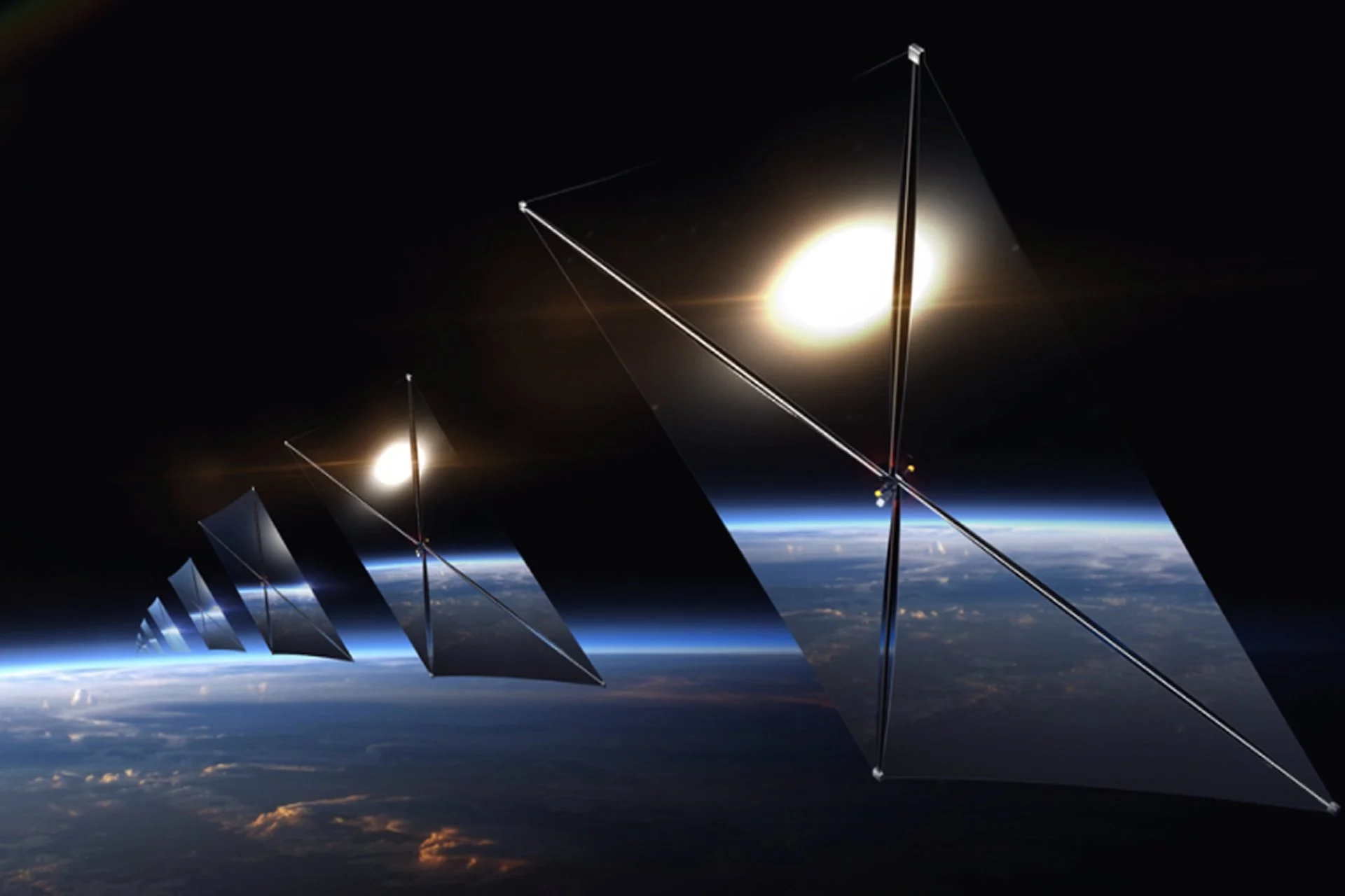
satellites that feature four triangular mirrors joined at their vertices to form squares, in orbit above earth

An illustration of Reflect Orbital's satellites in orbit. (Image credit: Reflect Orbital)

But thanks to atmospheric light scattering — the bouncing of photons off particles in the air — the area affected by the mirror's passage would be much wider, the study found. Even at a distance of nearly 9 miles (14 kilometers) from the beam, the sky would be brighter than when the moon is full. At a distance of 21 miles (34 kilometers), the light-polluted area above the horizon in the direction of the beam would still appear brighter than the night sky during a full moon.

That would be just a single mirror. But Reflect Orbital wants to fly 40,000 such satellites. Bakos said that data suggests that to trigger energy generation even in the most efficient solar panels of today would require the combined reflected light from at least 400 such mirrors at the same time. Together, the beam from those mirrors would be 10,000 brighter than the full moon, which, however, only makes up about 2.4 percent of the brightness of the sun, the paper states.

The sky glow resulting from these combined beams, the researchers found, would be visible from 50 miles away (80 kilometers), and extend the twilight zone up to 9 miles (14 kilometers) from the beam.

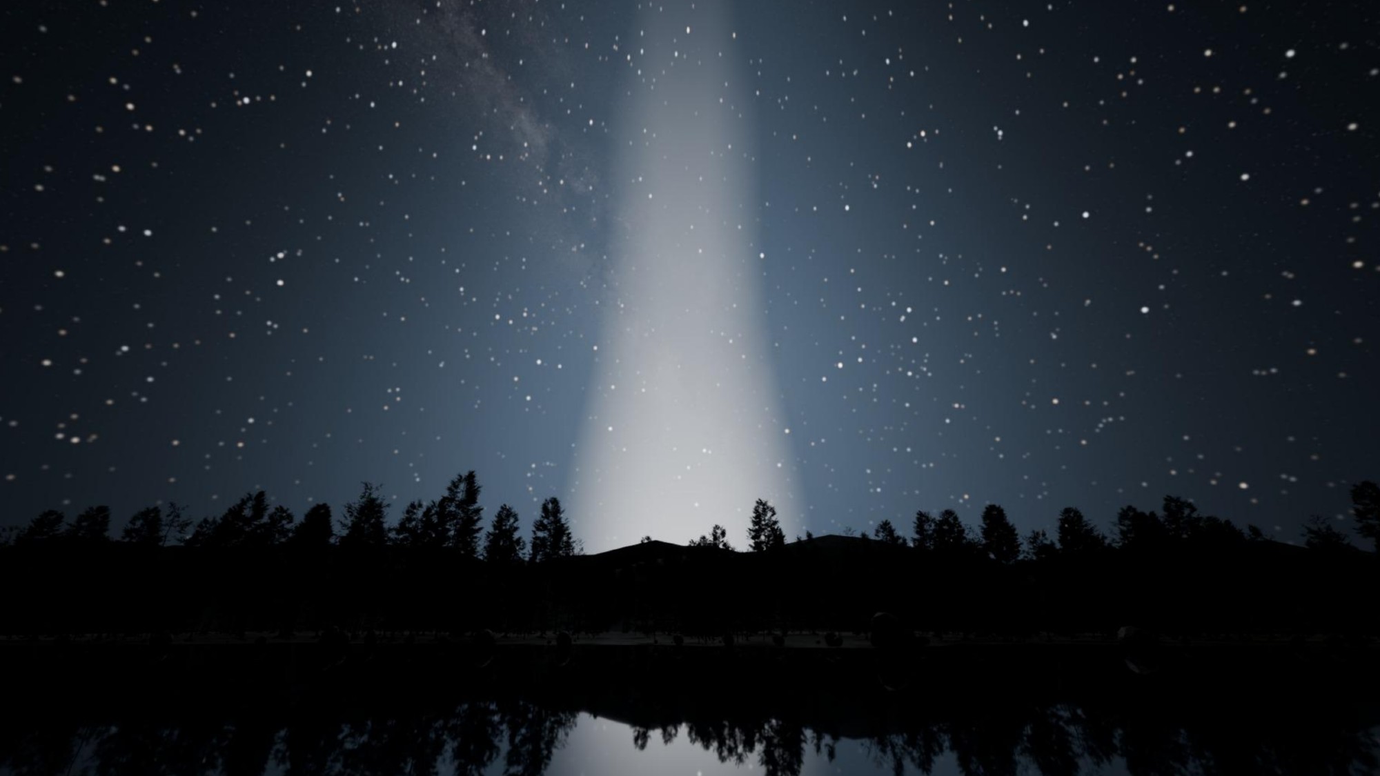
a bright beam of light obscures stars in the night sky

A rendering of the effect of Reflect Orbital's space mirrors on the night sky in a dark sky location. This image depicts a beam of light from one of the company's mirrors from roughly 8.5 miles (14 kilometers) away. (Image credit: Gaspar Bakos/Princeton University)

"It would be almost daytime brightness," said Bakos. "It would be just like before sunrise. But in fact, that's too low for solar panels to actually operate. Even the very best ones would barely turn on even with 400 mirrors illuminating the patch."

In renderings created by Bakos and his team based on the calculations, a pristine dark sky at a dark location is shown to completely transform into a star-free twilight zone as the mirror flies overhead.

Reflect Orbital's spokesperson told Space.com in response that the study's findings were based on "inaccurate assumptions" and insisted that "the vast majority of people will never see the light in their lifetime as the vast majority of service locations will be very remote," serving "large construction and solar projects in the middle of nowhere."

The spokesperson further added that "only the satellites required to serve approved locations would be active; inactive satellites would remain below naked-eye visibility."

The researchers, however, criticize the company for failing to provide technical data to back up their claims.

Reflect Orbital, however, insists that they "engaged substantively with legitimate concerns raised by astronomers, environmental researchers and scientists" and that such "feedback has informed our technology and operational plans."

The company says that they are "working on a coordination agreement with the National Science Foundation and commissioning third-party research through independent researchers and federal partners."

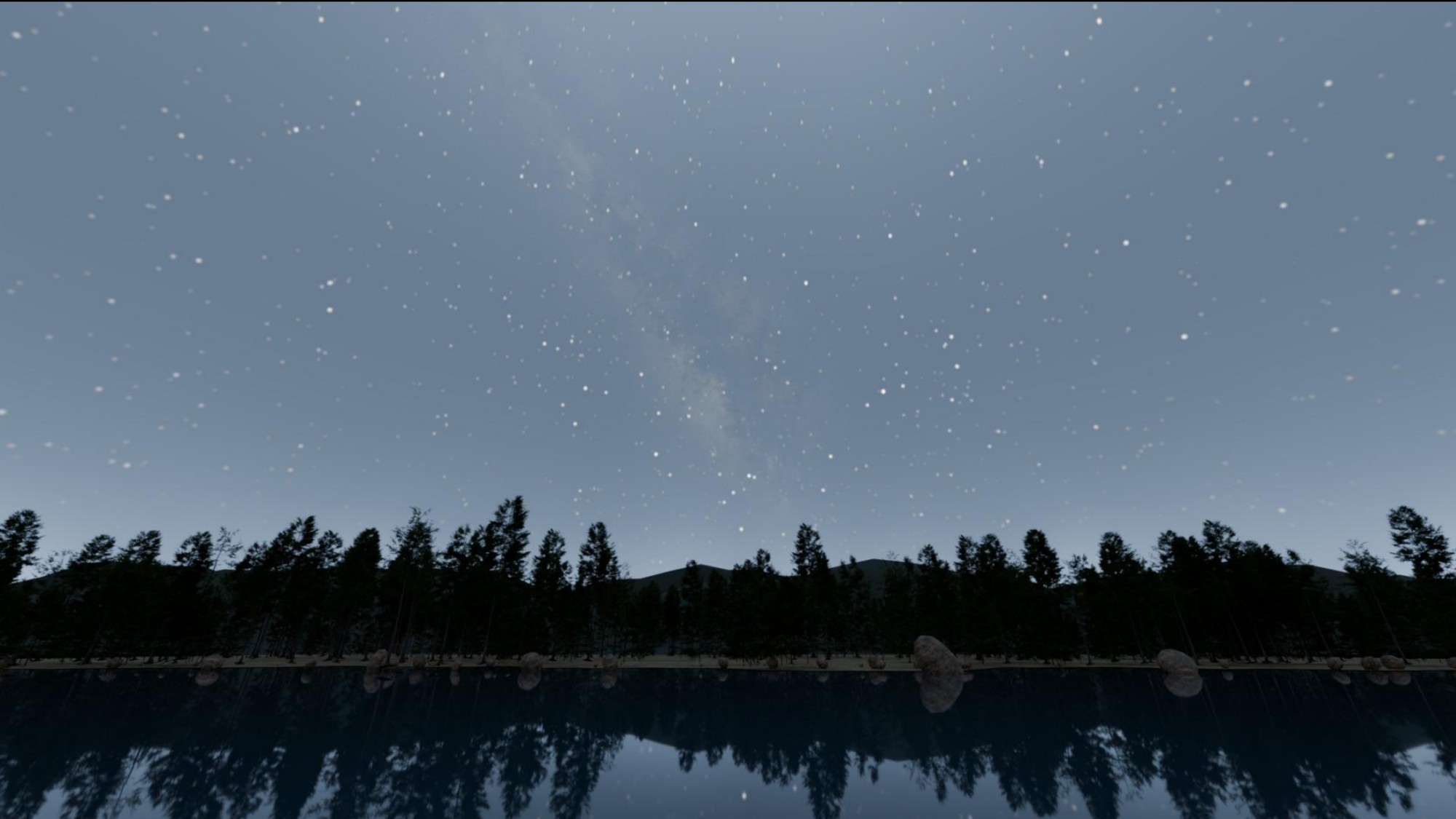
a night sky in which hundreds of stars are visible above a tree line

An illustration of the brightness of the full moon in a dark sky location. (Image credit: Gaspar Bakos/Princeton University)

For comparison, SpaceX's Starlink currently consists of around 11,000 satellites. According to some estimates, around 30 Starlink satellites are visible in the sky from a single spot on Earth at any point in time. Starlink satellites, however, are much smaller and dimmer than the Reflect Orbital mirrors.

Bakos said the overall effect of the mirrors would depend on the reflectiveness of the illuminated surface and the cloudiness of the sky. A forest, for example, might absorb most of the light while snow-covered fields or concrete city streets would scatter it further.

"It's not just the beam," said Bakos. "The glow of the reflected light from the surface will cause the sky to glow. For example the light pollution from a town illuminated by the beam will be ten to 20 times brighter than from the artificial lighting in that same town. Artificial light only illuminates streets and sidewalks, but here, everything would be illuminated — every backyard, park, roof or river."

The FCC received around 1,900 objections against the Reflect Orbital application. In its Order and Justification of Reflect Orbital's mission license, the agency stated that "impacts on optical astronomy fall outside [the FCC's] review and authorization."

In the U.S., satellite projects are exempt from the National Environmental Policy Act (NEPA), which requires federal agencies to assess environmental impacts of their decisions. The exemption has been in place since the 1980s when only a handful of satellites were being launched in a year.

The study was accepted for publication in the Astrophysical Journal and is currently available on arXiv.

NASA satellites ace world’s 1st ‘lost-in-space’ GPS-free navigation experiment

No GPS available in space? A satellite experiment may have a solution for that.

NASA's Starling mission — made up of a swarm of four cubesats in low Earth orbit (LEO) — is testing out navigation by using other satellites as moving landmarks. The hope is that this tech will allow future missions to navigate if GPS is not available.

The three-year-old tech demo will be extended beyond its previous expiration date this year until at least 2028, NASA announced on Monday (Aug. 17). The aim is to get the most out of the onboard experiment, a collaboration with industry partner EraDrive called FALCON (short for "Fast Autonomous Lost-in-space Catalog-based Optical Navigation").

"As NASA prepares for more missions beyond Earth's orbit, technologies like FALCON can support lunar satellite swarms, distributed science missions and human exploration," NASA officials said in Monday's statement.

While NASA's applications are civilian, alternative GPS solutions are also being investigated by the U.S. Department of Defense (DoD) out of concern that the limited number of GPS satellites could be vulnerable to adversaries. Earlier this year, for example, Space Force entities SpaceWERX and Space Systems Command jointly launched an initiative aiming for new ideas for "positioning, navigation and timing" (PNT) capabilities in space.

The aim of FALCON, however, is to deal with sheer distance. While satellites in Earth orbit have ample access to purpose-built navigational markers such as GPS, that access rapidly thins out as missions go farther afield. And this isn't just an abstract concern; NASA aims to send astronauts to the surface of the moon again as soon as 2028 on the Artemis IV mission, as part of a larger effort to build a moon base.

Industry and the military are also very interested in the moon and the area around it, known as cislunar space — and how best to navigate in the new environment. The moon's orbit also introduces complications to navigation; in 2025, for example, Canada's Outer Space Institute reported that "mass concentrations," or mascons, pull down on orbiting satellites and may affect their pathway, in some cases even inducing crashes into the lunar surface.

But before testing at the moon, NASA wants to learn more closer to home. It partnered with EraDrive, an autonomous spacecraft navigation company that originated with a group at Stanford University, which provided flight software and algorithms for FALCON. The experiment uses data from Starling's cameras, as well as a catalog on the spacecraft that charts thousands of known satellites and space objects around it.

The mission not only is trying out "GPS-independent navigation" but is also showcasing space situational awareness, or SSA — that is, the ability to understand the environment around the spacecraft (including other satellites). Some other spacecraft, like SpaceX's Starlink broadband satellites, use SSA to automatically dodge threats of space debris in LEO.

Starling's team is hoping to bring even more capabilities for navigation and SSA. "The results from FALCON can have far-reaching implications for on-orbit space-traffic monitoring, collision avoidance and alternative navigation," Roger Hunter, program manager for NASA's small spacecraft and distributed systems program, said in the statement.

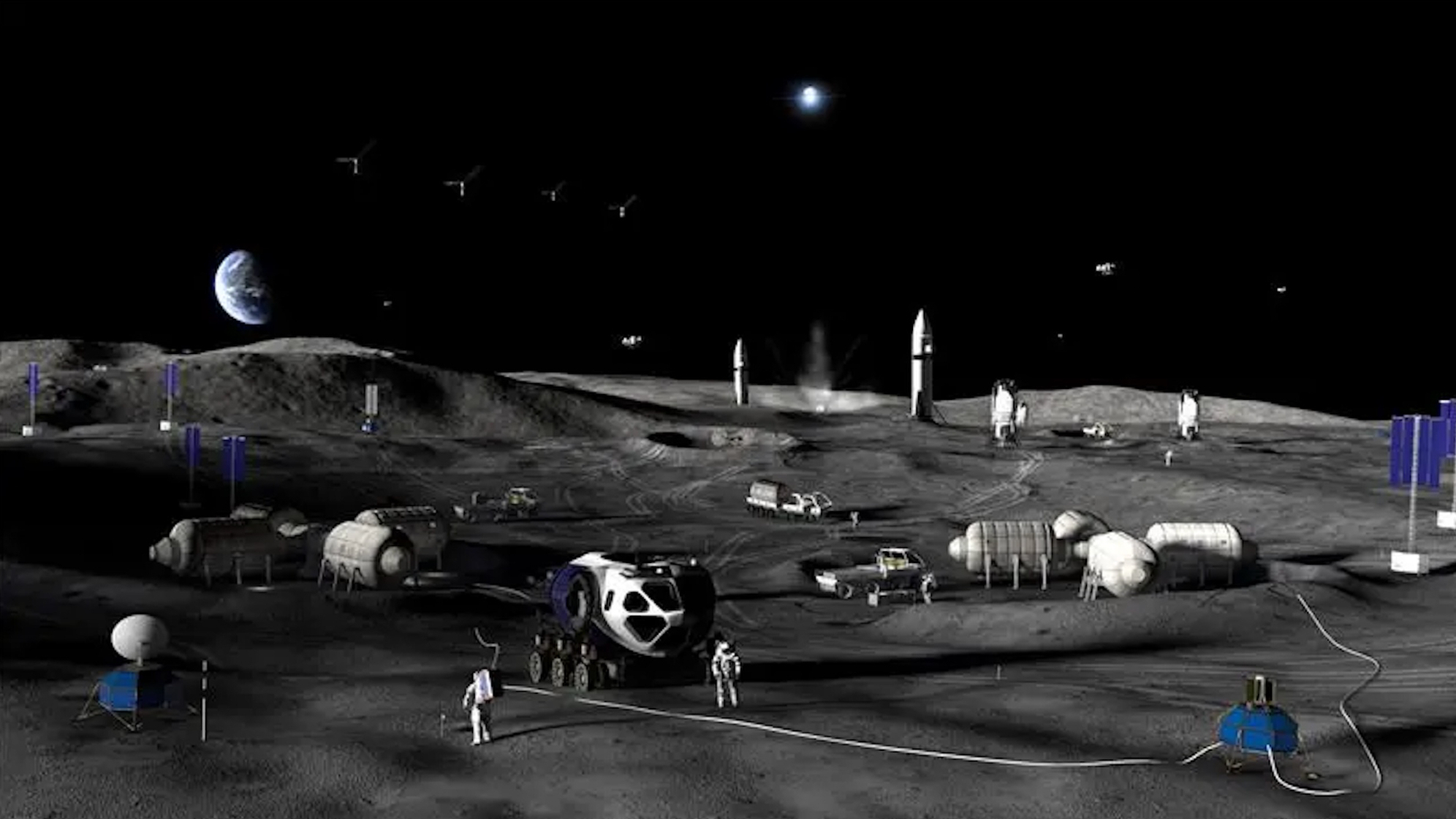
artist's illustration of a base on the moon.

NASA plans a to build a permanent base on the moon over the next decade or so, via a step-by-step approach. (Image credit: NASA)

FALCON notched two major milestones in its first three years. For PNT, the spacecraft used its cameras to observe other satellites and objects — and to match their information with the onboard database, which includes roughly 20,000 objects from publicly available DoD records. "FALCON then used the observed and verified objects as reference points to determine Starling's orbit," NASA stated.

FALCON's in-orbit observations also helped mission managers better understand the pathways of 200 individual objects, beyond the orbital estimates in the DoD catalog. The estimating work was performed over just three days and autonomously, meaning ground operators did not participate.

"The self-orbit determination capability made possible through FALCON is a first for spacecraft using optical cameras, to navigate by their relative position to other objects in space," NASA stated. "Separately, the catalog-update experiments produced better object position predictions onboard Starling than those provided by ground stations."

Starling's four spacecraft operate at an altitude of about 350 miles (565 km), which is about 6 miles (10 km) higher than originally planned. That's because SpaceX advised mission managers that Starling's mission plan put it at risk of coming close to Starlink satellites already operating in an orbital shell at 340 miles (555 km), according to Space News. By comparison, the International Space Station typically orbits slightly lower than Starling or Starlink, at 250 miles (400 km).

All of which is to say that the Starling mission demonstrates operations in crowded conditions. But in the future, NASA is hoping to port the lessons learned to the moon and Mars for science applications — meaning, to improve measurements from spacecraft — as well as for interplanetary traffic management.

US Space Force gives Rocket Lab $397 million to build threat-tracking ‘Flatellites’

Amid the major uptick in national defense space contracts since the Trump Administration announced plans to assemble a "Golden Dome" missile-defense system in orbit, Rocket Lab has landed another deal to contribute to the cause.

The California-based company was awarded a $397 million Space Force contract to design, manufacture and launch a fleet of "Flatellites" to augment existing infrastructure's ability to track airborne threats in real time. The project is funded under the Space Force's Space-Based Airborne Moving Target Indicator (SB-AMTI) program, and is one of several national security contracts that Rocket Lab has scored over the last two years.

"We are proud to contribute to the deployment of a resilient space-based sensing layer that will enhance the Joint Force’s ability to operate in contested airspace," said Rocket Lab CEO Peter Beck in an Aug. 4 statement.

The Flatellites deal is the company's single largest national defense contract so far this year. Since the beginning of 2026, Rocket Lab has now announced four major U.S. government-funded defense contracts worth a combined $943 million: $190 million from the Department of Defense for 20 HASTE (Hypersonic Accelerator Suborbital Test Electron) test launches, a $90 million Space Force contract for two satellites in geostationary orbit and another Space Force deal for $266 million to launch up to 18 missile-defense missions from Alaska.

Rocket Lab also recently unveiled GHOST design, a new deployable shipping container-based system capable of supporting Electron and HASTE launches for responsive national-security missions from mobile or temporary locations. And, during a recent earnings call, Beck voiced the company's intent to carry out the aforementioned Alaskan launches using GHOST (short for "Global Hypersonic & Orbital Spaceport Technology"), saying, "We've mastered the art of building launch sites. Now we're making them deployable worldwide."

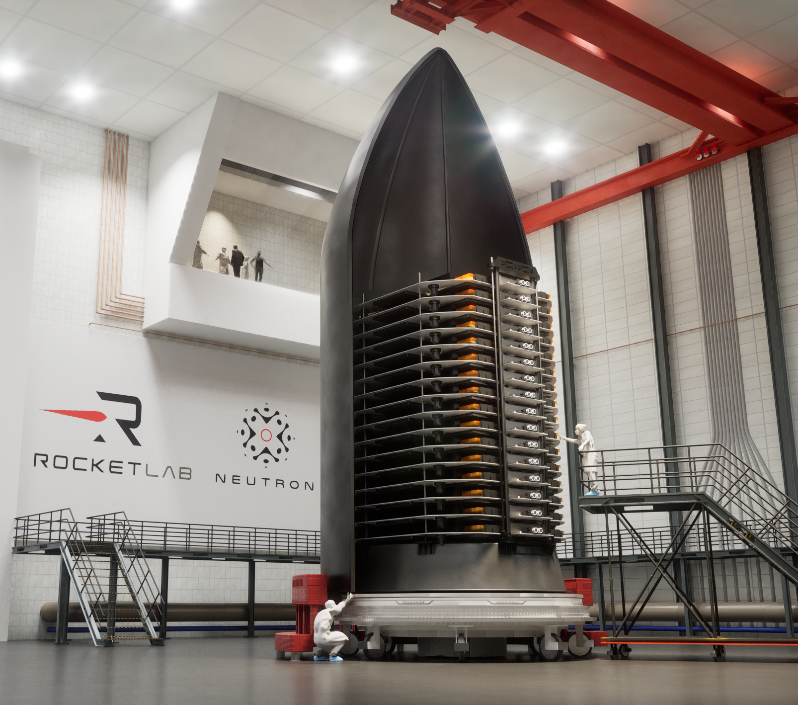
A stack of thin satellites sits in half a rocket fairing in a clean room.

Artist impression of Rocket Lab Flatellite spacecraft inside a Neutron launch vehicle fairing. (Image credit: Rocket Lab)

The flat design of Rocket Lab's Flatellites will increase the number of spacecraft that can be delivered per launch and has been optimized for orbital constellations, according to Rocket Lab's statement. The satellites will be equipped with low latency, high bandwidth communication systems and sensors for tracking adversarial air-based threats.

They will launch in stacks aboard Rocket Lab's upcoming Neutron rocket, similar to the payload bay configuration used for Starlink satellites on SpaceX Falcon 9 rockets. Neutron is Rocket Lab's next-generation launch vehicle designed to compete with Falcon 9 lift capabilities and partial reusability, and is currently expected to debut sometime near the end of this year or in early 2027.

New private ‘Perceptor’ probes will keep an eye on satellites high above Earth

Satellites high above Earth may soon have fewer places to hide.

San Francisco-based company Astranis announced today (Aug. 13) that it's developing a line of spacecraft called Perceptor, which will keep an eye on satellite activity in geostationary orbit (GEO).

GEO lies 22,236 miles (35,786 kilometers) above Earth, an altitude at which orbital speed matches our planet's rotational velocity. It's therefore a popular destination for communications, weather and reconnaissance spacecraft — and, increasingly, an arena for off-Earth spying, as space powers seek to keep tabs on their competitors' activities.

Astranis currently operates five satellites in this distant orbital realm, which "support the U.S. military, bring connectivity to remote areas and provide critical capabilities like GPS," according to the company's website.

It plans to leverage and extend this expertise with Perceptor, helping the U.S. government and other potential customers learn more about what's happening high above our heads. The new line will be based on Astranis' "MicroGEO" satellite platform, so named because it's smaller than typical GEO craft.

"Astranis provides mission-critical infrastructure for strategic higher orbits. What we found is our means to detect and respond to emerging threats to this infrastructure are sorely lacking," John Gedmark, Astranis' CEO and co-founder, said in a statement today.

"There are blind spots that will be used against us if not eliminated," he added. "With Perceptor, we're meeting the increasing demand for security in GEO with our proven on-orbit platform and ability to produce at scale."

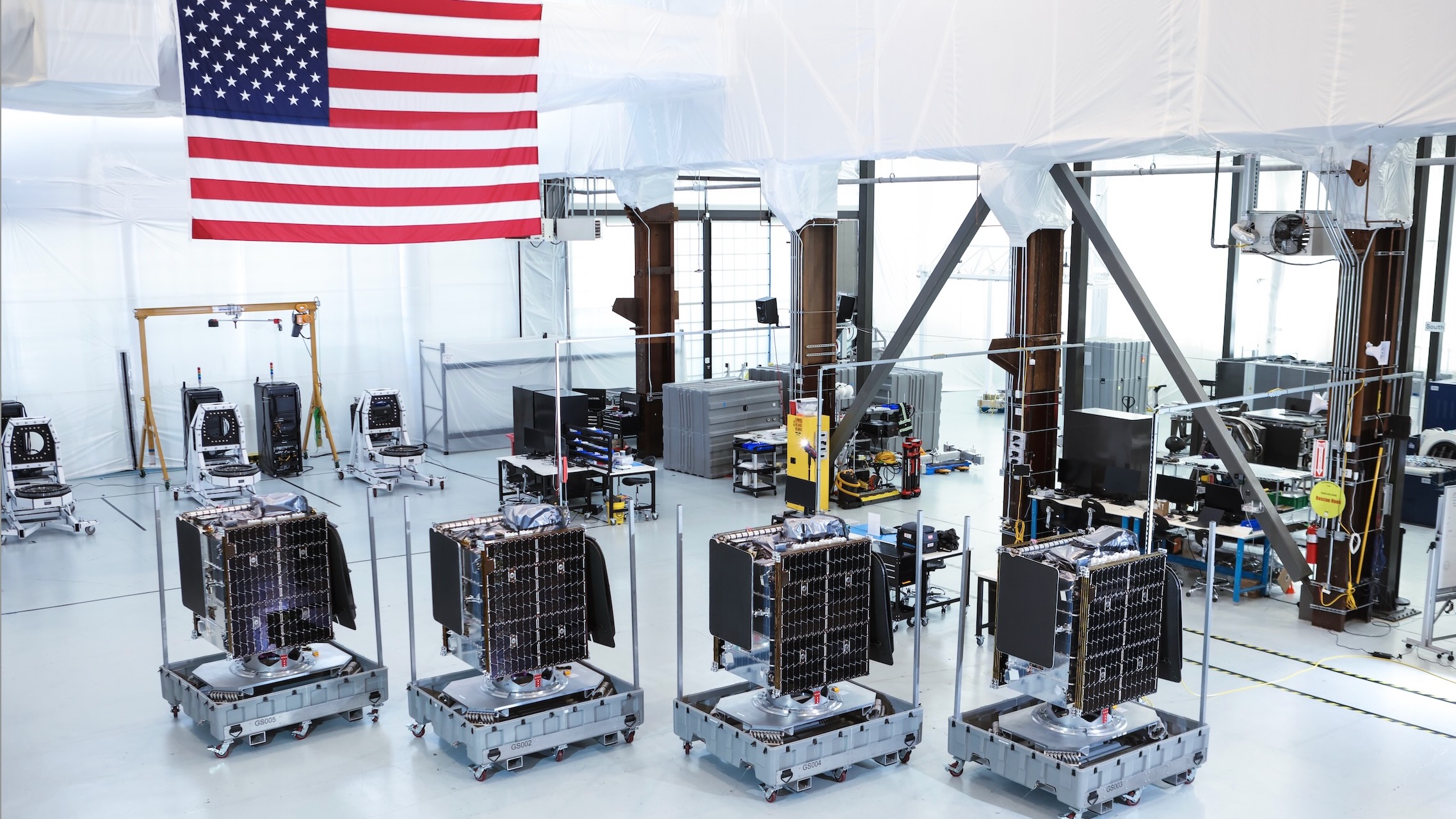
four cubical spacecraft sit inside a large white-walled clean room with an american flag in the background

Four Astranis MicroGEO satellites, which launched atop a Falcon 9 rocket in December 2024. (Image credit: Astranis)

Perceptor spacecraft will sport a variety of sensors, which will allow them to take the measure of other satellites and their broader GEO surroundings.

"Multi-angle flybys can assess spacecraft capabilities, help troubleshoot anomalies on friendly spacecraft, and provide additional eyes in a domain where awareness has historically been limited," Astranis' statement reads.

Each Perceptor will also be highly maneuverable, using electric propulsion "to traverse the full GEO arc, repositioning dozens of times over its mission lifetime," company representatives added.

The statement does not provide a target timeline for the first Perceptor missions. But the need for such a capability already exists, as the activities of certain Russian and Chinese satellites show.

In 2020, for example, officials with the U.S. Space Force announced that two Russian spacecraft got within 100 miles (160 kilometers) of an American spy satellite, behavior the branch's then-chief described as "unusual and disturbing."

And, in 2023, experts announced that China's TJS-3 GEO spacecraft had taken close looks at USA 233 and USA 298, both of which are thought to be Space Force spy satellites.