What lurks beneath the volcanoes of Jupiter’s moon Io? NASA’s Juno probe just took a peek

Scientists have measured temperatures beneath the surface of Jupiter's volcanic moon Io, offering the first-ever glimpse of the hidden heat driving the most volcanically active world in the solar system.

During close flybys of Io in late 2023 and early 2024, NASA's Juno spacecraft turned its Microwave Radiometer (MWR) instrument toward the moon, probing roughly six to 20 feet (two to six meters) beneath its surface. Originally designed to peer through Jupiter's thick clouds, the instrument instead revealed a powerful new way to study how heat moves through planetary crusts, according to a statement from the space agency.

"The surprising discovery that we could see below a rocky moon's surface has important implications for studying Earth's volcanoes," Scott Bolton, coauthor of the study and Juno's principal investigator, said in the statement. "Juno has taught us that if we look with an MWR-type instrument near a volcano on Earth, we might see a similar signature in the subsurface temperature gradient, providing new information on how terrestrial volcanoes work."

Until now, researchers had relied almost entirely on infrared observations, which detect only the temperature of Io's surface. By probing several feet underground, Juno has revealed how heat moves through the moon's crust for the first time.

The measurements showed temperatures rising by more than 40 degrees Fahrenheit (22 degrees Celsius) just a few feet below the surface — far more than sunlight alone could explain. Juno's subsurface heat map also revealed localized regions of elevated heat, with temperatures measuring between 18 and 36 degrees F (10 to 20 degrees C) warmer than the surrounding terrain, according to the statement.

Juno's observations uncovered another surprise, too. Despite being known for its towering mountains and active volcanoes, much of Io's surface appears remarkably smooth and composed of unusually low-density material. Researchers think the moon is blanketed by porous layers of volcanic ash, sulfur frost and other eruptive debris that continually resurface Io, burying older terrain beneath fresh deposits.

Scientists think the heat detected beneath Io's surface could be rising steadily from the moon's molten interior through a conductive crust or coming from pockets of cooling lava flows trapped just below the surface. Either way, the data provide the clearest picture yet of how Io transports heat from its interior.

Unlike Earth, where volcanism is driven largely by heat from radioactive decay, Io is continuously stretched and squeezed by Jupiter's immense gravity as it orbits the giant planet. This constant tidal flexing generates enormous amounts of internal heat, fueling hundreds of active volcanoes and making Io the most volcanically active object in the solar system. By improving scientists' understanding of how heat and magma move beneath a planet's surface before eruptions, the same microwave techniques used by Juno could one day help researchers better monitor Earth's volcanoes and improve eruption forecasting.

"Io provides a unique window into learning how tidal heating works throughout the cosmos, a fundamental process that provides energy and heat to worlds that are far from their parent star," Bolton said in the statement. "This process can not only create the most volcanic body in the solar system, in the case of Io, but also fuels the subsurface oceans on the moons of giant planets, such as Europa and Ganymede. Up until this point we could only observe the heat escaping at the surface or through eruptions. Now we can characterize how the heat is moving from the interior toward the surface."

Because Io is an extreme example of volcanic activity, it serves as a natural laboratory for studying how heat moves through planetary crusts. Those insights could help scientists better understand ancient volcanism on Mars, Venus, and Earth's moon, whose landscapes were shaped by massive eruptions billions of years ago.

The technique could also aid the search for life elsewhere. While Io itself is far too hostile to support life, microwave instruments can also probe beneath icy surfaces. Juno has already used the same instrument to study Jupiter's moons Europa and Ganymede, where scientists believe vast oceans lie hidden beneath thick shells of ice. Understanding how heat moves through those crusts is key to determining whether they could harbor environments suitable for life as we know it.

Their findings were published July 22 in the Journal of Geophysical Research: Planets.
This Week In Space LIVE: The Viking Mars landings 50 years later

Hey, Space Fans! Every weekend here at Space.com, you may have noticed we highlight the latest episode of the podcast This Week In Space, a TWiT show co-hosted by yours truly and my friend and colleague Rod Pyle, a space historian and editor of the National Space Society magazine Ad Astra.

This Week In Space episodes usually drop each Saturday, but this week we're doing something a bit different. To mark the 50th anniversary of NASA's Viking landings (Viking 1 touched down on Mars on July 20, 1976), Rod and I will host a special live taping of the podcast to discuss all things Martian starting at 1:30 p.m. EDT (1730 GMT). It should last up to 90 minutes.

Joining us on the podcast will be:

  • Dr. Pascal Lee, a planetary scientist, geologist and artist with the SETI Institute, Mars Institute and NASA Ames Research Center.
  • Dr. Penny Boston, an astrobiologist and speleologist (the study of caves) with the New Mexico Institute of Mining and Technology.

During our discussion, we'll touch on the personal and scientific impacts of NASA's Viking Mars landings and look at where Mars exploration may go in the modern age. We might even discuss the best places for the hunt for signs of life: the surface or inside Martian caves?

So if you're a Mars fan or a casual space aficionado, join us today at 1:30 p.m. EDT to get a detailed look at NASA's Viking Mars landings and their lasting impact on Martian exploration.

Scientists may have finally solved the mystery of the sun’s missing silver

For several years now, astronomers who study the sun have faced a little mystery — our star seemed to hold too little silver. Whenever scientists examined the sun's outer layers, they've seen significantly less silver than they've expected to find.

Where, then, did the missing silver go?

As it turns out, this mystery may finally be solved. Newly published research suggests that the sun's missing silver may have been hiding in plain sight all along.

At first, the real mystery might seem to be why you'd seek silver in the sun at all. After all, 98.5% of the sun's mass is made from lightweight hydrogen and helium. Silver is just a tiny fraction of the remaining 1.5%, which also includes traces of other heavy elements like iron and copper.

These trace elements can illuminate the history of the cosmos. Silver is thought to form when dying stars violently explode in supernovas. When astronomers find silver in the sun and other stars, they can retrace the silver's origins and how stars have evolved over the eons.

"By studying the light of stars of different types and ages, we hope to understand where silver is formed in the universe, and how it has been distributed throughout the Milky Way over time," says Sema Caliskan, the lead author of the research and now a postdoc at the University of Liège in Belgium, in a statement.

Silver is particularly interesting because it's also found in utterly ancient meteorites called CI chondrites. These meteorites formed from the same primordial matter that created the sun, 4.6 billion years ago. As a result, when scientists break into CI chondrites that have fallen to Earth, they expect to find silver levels that match those they see in the sun.

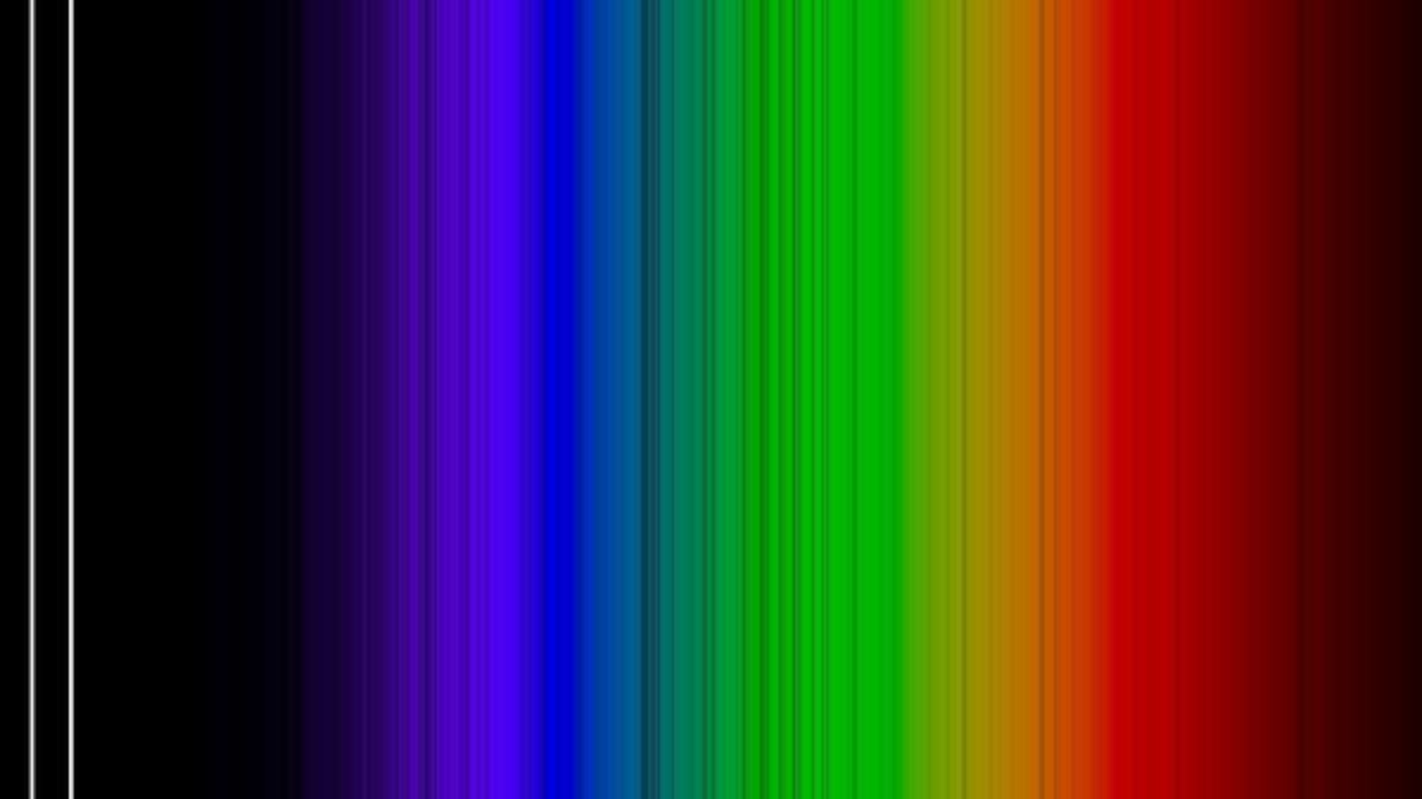
A rainbow assortment of spectral lines. On the left, where it's dark, there are two vertical white lines.

(Image credit: Anish Amarsi/Uppsala University)

Astronomers can measure the latter from afar by looking at sunlight's spectral lines. As light streams out from the sun's heart, it crashes into the atoms of our star's outer layers, which absorb the light at certain wavelengths. Look at a spectrum of sunlight, and you'll see dark lines where light has been absorbed. Atoms of different elements absorb different wavelengths, so each element leaves a distinct fingerprint.

Scientists can pore over these spectral fingerprints to reconstruct what elements created them and in what quantities. Therein lies the mystery: The sun seemed to contain much less silver than CI chondrites would indicate. This missing silver is a source for confusion in the sun's history.

Caliskan and her colleagues wondered if astronomers were missing something. They could not visit the sun in person, but they could still find where the silver might be hidden by simulating the sun's atoms on a computer. If they could create a high-silver model that still spawned the low-silver spectral lines, that model could be a good guess for the silver's whereabouts.

Other scientists had tried this before to limited success, but their simulations had been relatively simple. As light strikes an atom, the light has all sorts of intricate effects on the atom's innards. These effects can alter how the atom absorbs the light and, therefore, change how astronomers see that light.

Past models hadn't accounted for many of these tricky "non-equilibrium effects", because simulating them is far easier said than done. They're messy and complex and they vary a great deal from atom to atom.

In fact, no known scientists had ever tried to simulate a silver atom with non-equilibrium effects before Caliskan and her fellow investigators took on the challenge. They tried with their best guesses and the power of the Tetralith supercomputer in Linköping, Sweden.

Indeed, these non-equilibrium effects seem to explain the silver mystery. Based on their model, Caliskan and colleagues calculated that the sun holds 55% more silver than astronomers have measured.

This isn't a perfect match for the CI chondrites, but it's close enough that investigators can rule out any extraordinary cause. Instead, the missing silver may have been right there, in the sun all along, simply occluded from astronomers' view by tricks of physics. Next, Caliskan and colleagues plan to use this method to simulate other types of stars.

They published their work in the journal Astronomy & Astrophysics in July 2026.

Satellite spots a ‘hummingbird’ in Antarctica | Space photo of the day for July 23, 2026

A black and white hummingbird shape appears in data of a mountaintop.

A hummingbird shape in satellite data from NISAR is actually a mountaintop spotted in Antarctica. (Image credit: NASA/JPL-Caltech)

In satellite data captured over Antarctica, what appears to be a beautiful, colorful hummingbird emerges from the crest of a mountaintop.

What is it?

While there are no hummingbirds flying around Antarctica, we can see what looks like a small, purple bird in a new satellite image of an Antarctic mountain. The dark belly of this "bird" at the center of this image is actually the top of the mountain Nunatak Zaterjavshijsja in East Antarctica.

What looks like a bird's tail is a stream of ice flowing northeast all the way out to the ocean, and what appear to be feathers splaying outward from the mountaintop are actually crevasses down the mountain. These crevasses are formed by a glacier fracturing the mountain's surface as it flows in the icy current toward the ocean.

This view was captured by radar instruments onboard the satellite NISAR (NASA-ISRO Synthetic Aperture Radar) that launched as a collaboration between NASA and ISRO (Indian Space Research Organisation). The director of NASA's Earth Science Division called NISAR "the most sophisticated radar we've ever built" in a pre-launch briefing last year.

Why is it incredible?

At first glance, this image is puzzling. What could it possibly be? Its bold colors and sharp lines evoke almost alien qualities. But the strange beauty of the shapes and colors in this satellite image reveal important information about glacier movements on the mountain.

"First, it's a beautiful image, with rich details of features that provide insights to how the glacier is moving. Then, because radar can often see through snow and deep into the ice, NISAR can observe fundamentally different properties of Antarctic ice than can be seen in optical imagery," Seongsu Jeong, the signal analysis engineer who produced the image at NASA's Jet Propulsion Laboratory, said in a statement. "With NISAR we're seeing what's hidden beneath the surface."

And now anyone can explore NISAR's data. Earlier this week, on July 20, NISAR started making the data from its radar instruments public. Moving forward, mission teams will be rolling out this data so researchers everywhere can use it to study and protect our ever-changing planet.

After nearly 30 years, NASA realized this near-Earth asteroid is actually a comet. The discovery may help us defend the planet some day

A near-Earth object that astronomers believed was an asteroid for nearly three decades has been unmasked as a faint, active comet, revealing a case of cosmic mistaken identity that could help improve planetary defense.

The object, known since its discovery in 1998 as 1998 SH2, appeared to be an ordinary asteroid. It follows a 4.5-year orbit around the sun and showed no obvious signs of cometary activity, such as the glowing coma or tail produced when sunlight vaporizes surface ice.

However, during a close pass about 2 million miles (3 million kilometers) from Earth in August 2025, researchers using NASA's Deep Space Network planetary radar system noticed something unexpected: The object wasn't where orbital predictions said it should be, according to a statement from the space agency. That discrepancy prompted scientists to take a closer look, and what they found surprised them.

Using decades of precision optical astrometry — measurements of the object's position against background stars — researchers found that gravity alone couldn't explain its irregular motion. Instead, they detected tiny nongravitational forces consistent with jets of gas escaping from the object's surface as hidden ice warmed in sunlight.

"After we measured the nongravitational perturbations affecting the motion of 1998 SH2 and recognized they weren't compatible with the object being an asteroid, we suspected the object could be an active comet," Davide Farnocchia, lead author of the study and navigation engineer with NASA's Center for Near-Earth Object Studies at the Jet Propulsion Laboratory, said in the statement.

To test the idea, the team observed the object with the European Southern Observatory's Very Large Telescope in Chile and the Canada-France-Hawaii Telescope atop Mauna Kea. The observations revealed a faint but unmistakable comet tail, confirming the object's true identity.

The discovery earned 1998 SH2 a second designation: P/1998 SH2, officially recognizing it as a comet. Beyond solving the mystery, the finding has important implications for planetary defense.

Unlike rocky asteroids, comets can subtly change course as gas escaping from their surfaces acts like tiny thrusters. Identifying those nongravitational forces allows scientists to more accurately predict an object's future orbit and assess any potential impact risk.

"This work shows the importance of continuously tracking near-Earth objects," Farnocchia said in the statement. "Because of outgassing, the motion of comets is more significantly perturbed than that of asteroids.

"Detecting these perturbations can be an important diagnostic tool for planetary defense that will help understand which objects may be comets rather than asteroids, how their orbits evolve, and how that influences their Earth impact risks."

The study also suggests that 1998 SH2 may not be unique. The researchers noted that analyzing the motions of near-Earth objects with increasingly precise astrometry could reveal more hidden comets that have long been classified as asteroids because they lack obvious tails or glowing comas.

As astronomers continue to monitor the growing population of near-Earth objects, subtle orbital changes may prove just as revealing as spectacular comet tails, uncovering more examples of cosmic mistaken identity while helping scientists better understand which objects pose potential threats to Earth.

Their findings were published July 10 in the journal Nature Astronomy.

Our 1st-ever up-close look at the Martian surface | Space photo of the day for July 22, 2026

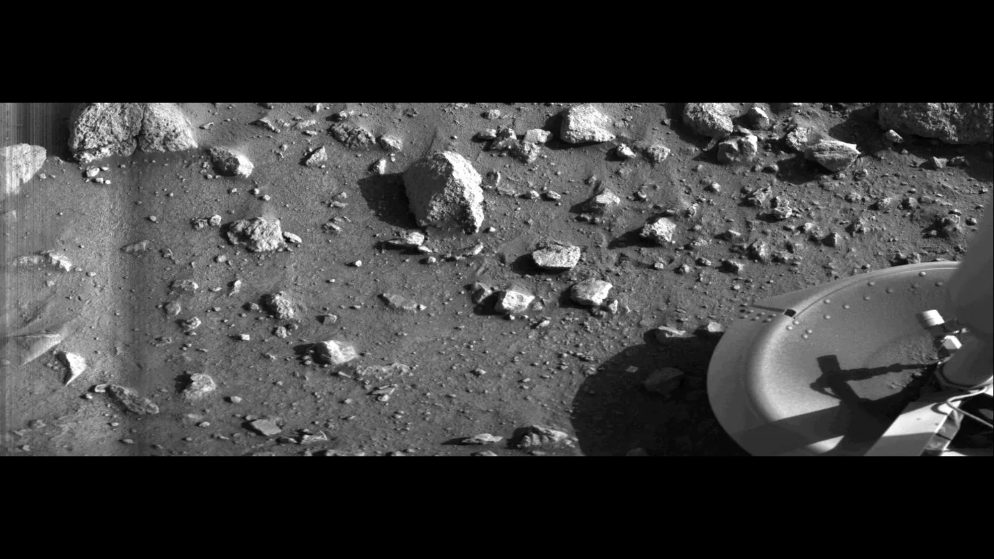
A black-and-white image of the surface of Mars with rocks and part of the Viking 1 lander.

The first-ever photo captured on the surface of Mars, snapped on July 20, 1976 by NASA's Viking 1 lander. (Image credit: NASA/JPL)

You're looking at history. What might seem like a simple black-and-white picture of some rocks is actually the first photograph ever taken on the surface of Mars.

What is it?

Bright and early on the morning of July 20, 1976, NASA's Viking 1 lander touched down on the surface of Mars. This moment 50 years ago marked the first fully successful touchdown on the Red Planet, and, pretty much as soon as it landed, Viking 1 captured the first image of the Martian surface.

The Soviet Union had already made multiple Mars landing attempts, all of them failures to some degree. The nation's Mars 3 lander did manage to survive its landing initially in December 1971, but it lost contact less than two minutes later.

Viking 1 did more than just survive. While its mission tasked the lander with studying the planet for 90 days after landing, it lasted over six years on the planet and made some incredible observations. The Viking 1 lander worked in tandem with an orbiter by the same name, and was soon joined at Mars by Viking 2, another lander/orbiter pair.

Why is it incredible?

It has now been 50 years since Viking 1's historic first, which opened our eyes to the Martian surface. And NASA has kept improving technologies and exploring further on Mars ever since. Agency rovers began scouring the planet's surface in the 1990s, so we have gathered data on the planet's surface for decades upon decades at this point.

But in 1976, no one had ever seen the surface of Mars close up. This view was preceded by science fiction like Ray Bradbury's "The Martian Chronicles," which painted fantastical possibilities about what it might really be like on Mars. With Viking 1's view, we finally got some concrete evidence of the reality on the planet.

In 50 years, our understanding of Mars, our solar system and beyond has grown tremendously. But with each major accomplishment, we can look back at previous milestones such as this to see the stepping stones that paved the way to get us there.

New timelapse video shows NASA’s Psyche spacecraft zooming by Mars

Swelling from a razor-thin crescent into a cratered world before fading back into the darkness, Mars gave NASA's Psyche spacecraft both a spectacular view — and a 1,000-mph boost toward its namesake asteroid.

A new time-lapse video released by NASA, stitched from images taken throughout May, captures the probe's month-long encounter with Mars. On May 15, Psyche swooped within 2,864 miles (4,609 kilometers) of the surface, using the planet's gravity to boost its speed and adjust its trajectory toward asteroid Psyche, a metal-rich world in the main asteroid belt between Mars and Jupiter that the spacecraft is scheduled to reach in 2029.

"This gravity assist was years in the making, and the navigation team nailed it — Psyche flew by Mars on exactly the trajectory we needed to set us on a path to rendezvous with the asteroid in the summer of 2029," Bob Mase, Psyche's project manager at NASA's Jet Propulsion Laboratory in California, said in a statement.

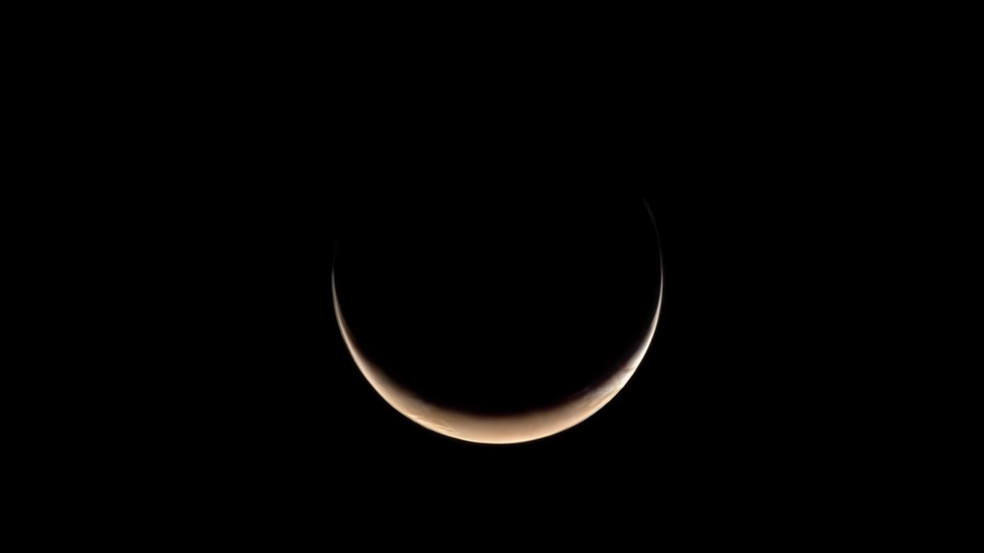
A crescent that's slightly reddish over a pitch black background.

A screenshot from the timelapse, showing Psyche approaching a crescent Mars. (Image credit: NASA/JPL-Caltech/ASU/True Story Films)

Approaching from a steep or what scientists call a "high phase" angle relative to the sun, Psyche initially caught Mars as a slender crescent with just 4 percent of its disk illuminated and its thin atmosphere glowing in scattered sunlight, Hannah Zigo, a Psyche team member at the Arizona State University, said in a NASA video accompanying the statement.

As the spacecraft closed in, the video follows Mars steadily expanding to reveal numerous craters puncturing its surface, the ancient double-ringed Huygens crater and the south polar ice cap before receding in the spacecraft's rearview.

The flyby served a dual purpose. By aiming Psyche's suite of instruments at a well-studied world, engineers say they calibrated and validated the spacecraft's scientific payload ahead of its 2029 destination.

"We didn't anticipate big discoveries, given how extensively the planet has been studied," Lindy Elkins-Tanton, principal investigator for the Psyche mission at the University of California, Berkeley, said in the statement, "but we did complement Mars science with the data we collected through Psyche's unique perspective."

All three of the spacecraft's science instruments performed as expected, according to NASA. Its gamma-ray and neutron spectrometer, designed to determine the asteroid's elemental makeup, detected the predicted surge of escaping neutrons during closest approach, confirming its operational readiness.

The mission's magnetometer, which will search for evidence that asteroid Psyche is the metallic core of an early planetesimal, recorded its first magnetic signature from a planetary body since its launch in 2023, detecting the bow shock where the solar wind meets Mars' magnetic environment.

Psyche's twin multispectral cameras also passed their calibration tests, capturing the frames for the time-lapse while spotting Mars' tiny moons, Phobos and Deimos, from a distance, the NASA statement read.

Spotting the moons served as "a practice for the satellite search that we'll use at the asteroid Psyche to look for any moonlets there," Jim Bell, a planetary scientist at Arizona State University who leads the multispectral imager instrument team, said in the statement.

With Mars in its rearview and its instruments fully vetted, Psyche remains locked on course for its summer 2029 rendezvous with the metal asteroid.

"The spacecraft is in great shape, and we're on schedule to resume sustained thrusting with the solar-electric propulsion system later this fall," Mase said.

A massive crater was spotted on Google Earth. It could be a scar from an ancient meteorite impact

An amateur astronomer's plans for a camping vacation two years ago transformed into a possible crater find in Canada's north.

Amateur astronomer Joël Lapointe, using Google Maps to figure out his route for the 2024 vacation, saw some odd terrain in Quebec's Côte-Nord region centered on Lake Marsal. Lapointe suspected it was an impact crater from a meteorite, and made a report on Impact Earth — a crowdsourcing website for craters with Canada's Western University in London, Ontario near Toronto. Western planetary geologist Gordon Osinski made a visit to the region in 2025, provisionally not only confirming the crater, but saying it's probably one of the biggest discovered in recent years. The 390-million-year old feature is roughly 15 miles (25 kilometers) wide.

In an email interview with Space.com while on travel in Scotland, Osinski — known as "Oz" by the space community — said to his knowledge the last discovery of that scale was the approximately 31-km (19-mile) Hiawatha structure, also possibly a crater, spotted in Greenland in 2018. "However, that structure is completely buried by ice, so its diameter is uncertain and there is still some controversy about its origin," Oz said.

But in the case of the new crater, called Uhackatik with approval from the Innu Council of Ekuanitshit in whose traditional lands the crater lies, there is no doubt at all where the crater came from. Oz's expedition to the area revealed "shock metamorphic effects", which are deformations to the rocks induced by the shock waves and heating produced by a meteorite impact.

"Impact melt rocks are like they sound: large volumes of rock that are melted by the impact event, but then cool and crystallize to look a lot like volcanic rocks," he said. "Finding these preserved — as they are usually some of the first parts of a crater to be eroded — was a big surprise."

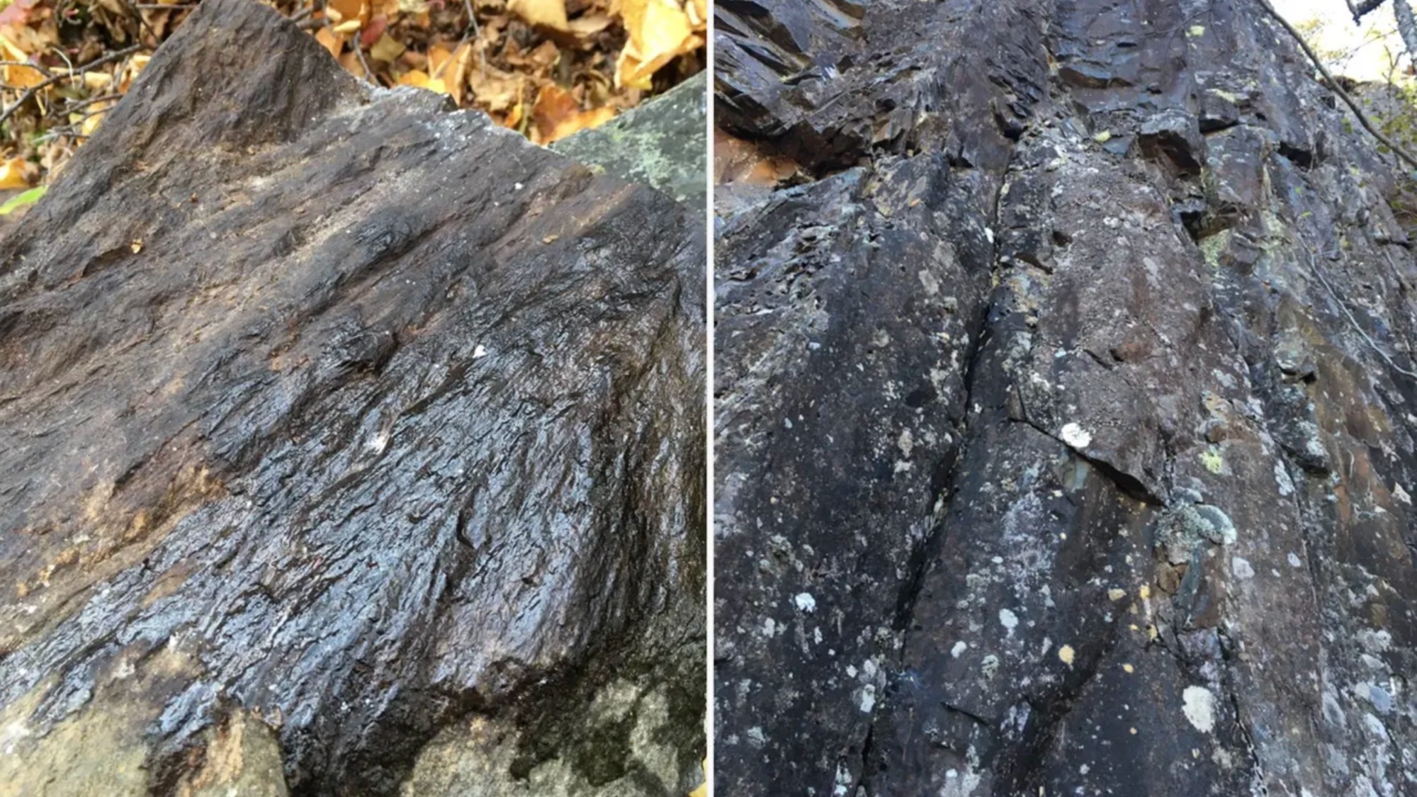
While most of the features are microscopic, Oz said in the field he and his collaborators could easily see "shatter cones", which are branching features in rock layers produced by the shockwave of impact. The research is not yet peer-reviewed, but it will be presented at the 88th Annual Meeting of the Meteoritical Society in Frankfurt, Germany in August.

two photos of rocks with cone-like striations on them

A shatter cone seen in rocks found at the center of the structure (left); melt rock found 2.5 miles (4 kilometers) west of the structure's center. (Image credit: Gattacceca, J. et al.)

While 400-million-year-old impact craters on Earth are hard to find, as geologic activity as well as erosion change their features over time, the precious evidence is helpful for scientists to better understand meteorite impacts on the moon, Mars and other rocky extraterrestrial bodies.

In terms of age, Oz noted, the moon's prominent Tycho crater best represents what Uhackatik probably looked like 390 million years ago. But On Earth, one of the best comparisons to Uhackatik is a moon-like crater used to help the Artemis II astronauts get ready for their moon mission this year.

That Earth crater is called Kamestastin (also known as Mistastin) in northern Labrador, Canada. Oz regularly runs expeditions there in consultation with the Mushuau Innu First Nation, as the crater lies within their traditional hunting grounds. Kamestastin includes anorthosite, a common mineral found in craters at the moon's south pole, where NASA hopes to land astronauts under the US-led Artemis program.

Artemis II astronauts Jeremy Hansen (from the Canadian Space Agency or CSA) and Christina Koch (NASA), as well as CSA backup astronaut and lunar-flyby capcom Jenni Gibbons, did an expedition to Kamestastin crater in 2023 alongside Oz and collaborators.

"For comparative craters [to Uhackatik], Kamestastin is actually a great one as the size is very similar," Oz said. "Kamestastin is well-preserved and I've worked there a lot … so in my mind, I was using Kamestastin as a template for exploring this new potential crater."

To fully confirm Uhackatik's extraterrestrial origin, Oz and collaborators are examining samples microscopically for more evidence of shock effects, such as chemistry indicating a high-temperature melt, or deformation effects in the quartz. In the meantime, Oz's lunar work with NASA continues: he will be part of the geology teams supporting the moon-landing astronauts during the Artemis 4 and 5 missions, which will touch down as soon as 2028.

50 years after Viking 1’s historic Mars landing, NASA is looking to the Red Planet’s skies

Half a century after first putting hardware down on Mars, NASA is looking to explore the Red Planet's skies.

On July 20, 1976, the Viking 1 lander touched down in the western reaches of Chryse Planitia (the "Golden Plain"), a large circular landform that lies 22.5 degrees north of the Martian equator.

It was the first-ever Mars landing for NASA. Viking 1, along with its twin Viking 2, went on to conduct the first fully successful mission on the Red Planet's surface. (The Soviet Union's Mars 3 probe survived its touchdown attempt on Dec. 2, 1971 but died less than two minutes later.) And those missions have left a rich and intriguing legacy.

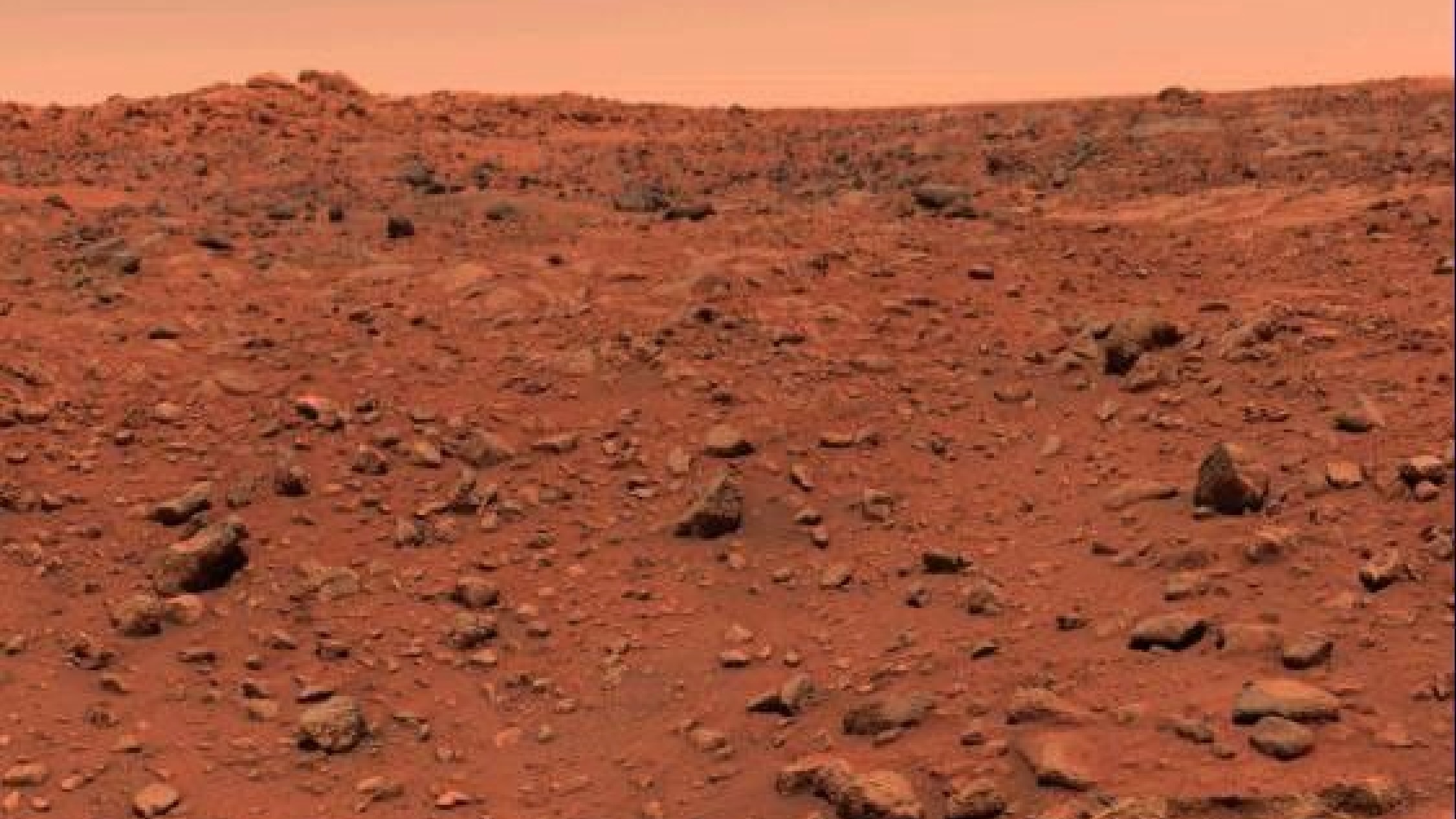
photo taken on the surface of mars, showing red dirt studded with many large rocks

The first color image ever captured on the surface of Mars. NASA's Viking 1 lander took this photo on July 21, 1976. (Image credit: NASA)

Viking 1 and Viking 2 — which touched down in a different Red Planet region on Sept. 3, 1976 — were sent to the surface to search for signs of life on Mars. (Each mission also featured an orbiter, which studied the planet from above.)

The landers did this using three different experiments, two of which returned negative results. But the third, called Labeled Release (LR), was different. LR observed a steady stream of carbon dioxide gas coming from dirt into which it had introduced nutrients — a possible sign of microbial metabolism.

Some scientists deemed the LR results a likely life detection. But most disagreed, ascribing them to abiotic reactions and stressing that, overall, the Viking data paint a picture of a dead planet.

That disagreement illustrates one of the main legacies of the Viking program: It showed researchers that hunting for extraterrestrial life is a complicated business, and they needed to learn more about Mars before attempting the search again on the Red Planet.

NASA didn't send a surface craft to Mars for another two decades, a hiatus caused in part by the Vikings' ambiguous results and high price tag, as well as a shifting of funds to the nascent space shuttle program.

The dry spell was broken in July 1997, when the agency's Pathfinder lander touched down in Chryse Planitia, about 530 miles (850 kilometers) from Viking 1. The main goals of Pathfinder's mission were to demonstrate a new "faster, better, cheaper" method of Mars exploration, prove out a new airbag-based landing system and get a mobile robot onto the red dirt.

Pathfinder achieved all of these objectives, notching the third by deploying a small rover named Sojourner. The little wheeled robot stumbled across rounded pebbles — strong evidence that they had been exposed to flowing water.

This discovery helped shape a new NASA Mars exploration strategy, one that aims to make an informed search for alien life after "following the water." Life as we know it depends on water, so the agency built rovers designed to hunt for signs of past liquid water and potentially habitable environments.

The twin golf-cart-sized rovers Spirit and Opportunity landed in 2004, and the car-sized Curiosity followed suit in August 2012. Then came Perseverance, which landed inside Mars' Jezero Crater in February 2021.

All of these wheeled explorers found evidence of past aqueous environments. Curiosity and Perseverance — with their more extensive and sophisticated scientific payloads — delved even deeper, discovering complex organic molecules that may have been produced by life as we know it.

The two latter rovers are continuing their work; both remain active on the Red Planet. (Pathfinder and Sojourner operated for about three months; Spirit was declared dead in 2010 and Opportunity fell victim to a Mars dust storm in 2018.)

Perseverance has collected a variety of Mars samples, which NASA wants to return to Earth for detailed study. As the Vikings' experience suggests, such a level of intense scrutiny may be necessary to make a definitive detection of life on Mars, if it indeed exists. (Getting those samples home is not a foregone conclusion, however; NASA's original plan was deemed too expensive, and it's now looking into a new return strategy.)

Perseverance also carried a little robotic companion, which heralded a new phase of Red Planet exploration — the Ingenuity helicopter.

Ingenuity was a technology demonstration, designed to show that rotorcraft could effectively ply the thin Red Planet skies. (Mars' atmosphere is just 1% as dense as that of Earth at sea level.)

The $80 million mission was a rousing success. The 4-pound (1.8 kilograms) Ingenuity was expected to make just five short hops on Mars but ended up flying 72 times over the course of nearly three years of activity. (Its first flight occurred on April 19, 2021, and its last was on Jan. 18, 2024.)

So NASA aimed higher, drawing up plans for future helicopter missions that could collect valuable scientific data. And such a mission is on course to launch in 2028, if all goes according to plan: Skyfall, which will send three Ingenuity-like choppers to Mars on a nuclear-powered rocket.

"Equipped with a suite of scientific instruments, these aerial scouts will map hidden ice deposits and analyze weather patterns," NASA officials wrote in a description of Skyfall. "The mission will also demonstrate how aerial vehicles can generate wide terrain and subsurface maps to identify safe and resource-rich destinations for future American astronauts venturing to Mars."

And Skyfall could be just another step toward even more ambitious aerial exploration on the Red Planet. NASA's Jet Propulsion Laboratory in Southern California, which built and operated Ingenuity, is looking into larger, more capable Mars helicopters that could do a wider variety of work on the Red Planet.

This is all part of Viking 1's legacy. That historic touchdown on Mars half a century ago lifted exploration up — all the way into the skies of another world.

Ancient sandstorm leaves behind wreckage on Mars | Space photo of the day for July 20, 2026

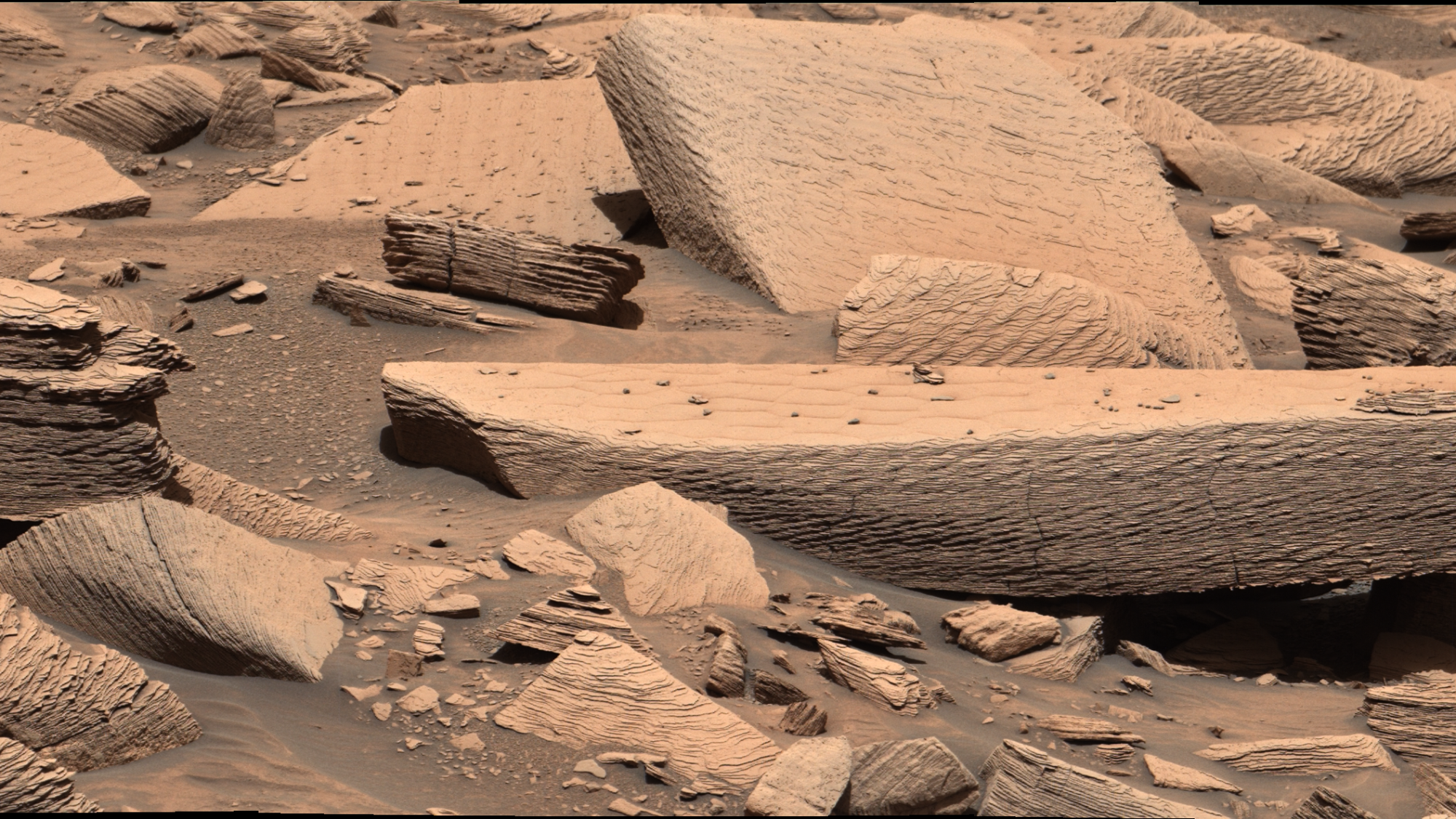
Sandy-colored large and small rocks on the Mars surface.

NASA's Curiosity rover snapped this image on the surface of Mars, and scientists think it's the wreckage of an ancient sandstorm. (Image credit: NASA/JPL-Caltech/MSSS)

NASA's Curiosity rover has uncovered evidence of ancient sandstorms on the Red Planet.

What is it?

Scientists think ancient Mars was quite different than it is today. While we might know it now as a barred, reddish wasteland, billions of years ago it actually had an atmosphere. Scientists even think that it had flowing rivers and expansive lakes.

And with observations from the Curiosity rover, researchers are exploring ancient sandstorms they think blew across the Martian landscape.

In this image Curiosity snapped, you can see what experts think is the aftermath of an especially extreme sandstorm in a spot nicknamed "Jawbone Canyon." Winds from this storm were likely so extreme that they pushed sand into rippling waves that eventually hardened into rock.

And if you really look closely at this image, you can almost see how the rocks appear to have ripples on them.

While the image was captured in 2024, a new investigation of the observation and discovery of this sandstorm was described in a study published this year in the journal Geology.

Why is it incredible?

This observation by Curiosity is part of a long history of exploration on the Martian surface that actually began 50 years ago today.

On July 20, 1976, NASA's Viking 1 lander touched down on the Red Planet. Aside from the Soviet Mars 3 lander that lasted only a few seconds on the world before losing contact, Viking 1 was the first Mars lander to survive landing and successfully went on to study the planet.

Viking-1 took the first-ever images on the surface of Mars, studied the planet's soil and really sparked investigation of whether or not the world may have ever supported life. Thanks to the success of this mission 50 years ago, today we have rovers like Curiosity and Perseverance on Mars leading us at the cutting edge of exploration.