Did Viking 1 find life on Mars 50 years ago? Here’s why the debate continues

In looking back and commemorating the 50th anniversary of the Viking missions to Mars, one is struck by the bold and audacious undertaking.

Twin spacecraft missions — each consisting of a lander and an orbiter — made their way to Mars and into the history books. The Viking 1 lander planted its legs on the terrain of Chryse Planitia 50 years ago today, on July 20, 1976, while its Viking 2 counterpart touched down at Utopia Planitia on Sept. 3 of that year.

Among their duties, the dual landers scooped up the first soil samples of Mars and deposited those precious collectibles into onboard, specialized equipment. Viking scientists had designed that gear to help answer an intriguing question: Is there life on Mars?
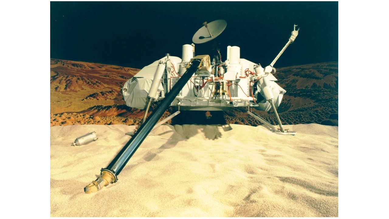
a model mars lander inside a room here on earth, stretching a long black arm into a sandy area

A model of NASA's Viking 1 lander here on Earth. On July 20, 1976, the spacecraft touched down on the surface of Mars. (Image credit: NASA)

One of Viking's instruments was a GCMS, a combination of a gas chromatograph (GC) and a mass spectrometer (MS). A positive GCMS detection could confirm the possibility that organics needed for the origin of life as we know it were present.

After interpreting all the data and information gleaned from ingested Martian soil, most scientists at the time concluded that Viking relayed a "no life on Mars" result.

But is it possible that the two robots actually radioed back a very clear comeback: "Can you repeat the question?"

Different techniques

Ben Clark was a member of the Viking science team, and the instrument he designed made the first-ever measurements of the chemical composition of Mars soil. He is now a senior research scientist at the Space Science Institute in Boulder, Colorado.

"There were three life-detection experiments, each using different techniques to probe whether they could stimulate biological activity in the soil by adding various selected nutrients," Clark told Space.com. "Two were generally negative in their findings, but a third experiment had an expected strong response when it added nutrient."

Indeed, astrobiologist/inventor Gilbert Levin remained convinced that his Viking microbial detection instrument, called the Labeled Release experiment, did find living microorganisms in the soil of Mars. He held tight to that view until he passed in July 2021 at the age of 97.

Skeptical scientists

Clark recalled that many members of the scientific community were skeptical when geochemists pointed out that certain minerals can cause a similar response.

"Furthermore, when a second amount of nutrient was added, there was no additional response," Clark said. "Did the organisms die between experiments?"

Because of these responses, and especially because no organic molecules could be detected, most biologists concluded there was no life in the dirt that Viking tested. "However, there is also the question of whether the best nutrients were used in the Viking tests," Clark noted.

Microbiologists who study the small organisms that live in Earth soil, Clark added, know that some species are extremely adept at using sulfate as an energy source, by combining it with organics or with hydrogen gas.

"Unfortunately, none of the Viking life-detection experiments added hydrogen gas to their chambers," Clark said.

"Ironically, the instrument which searched for organics in the soil, the GCMS, used hydrogen gas in its analytical technique," he added. "Thus, there was a tank full of hydrogen gas located just centimeters away from the life-detection experiment package, but no connection between it and the GCMS where it was located."
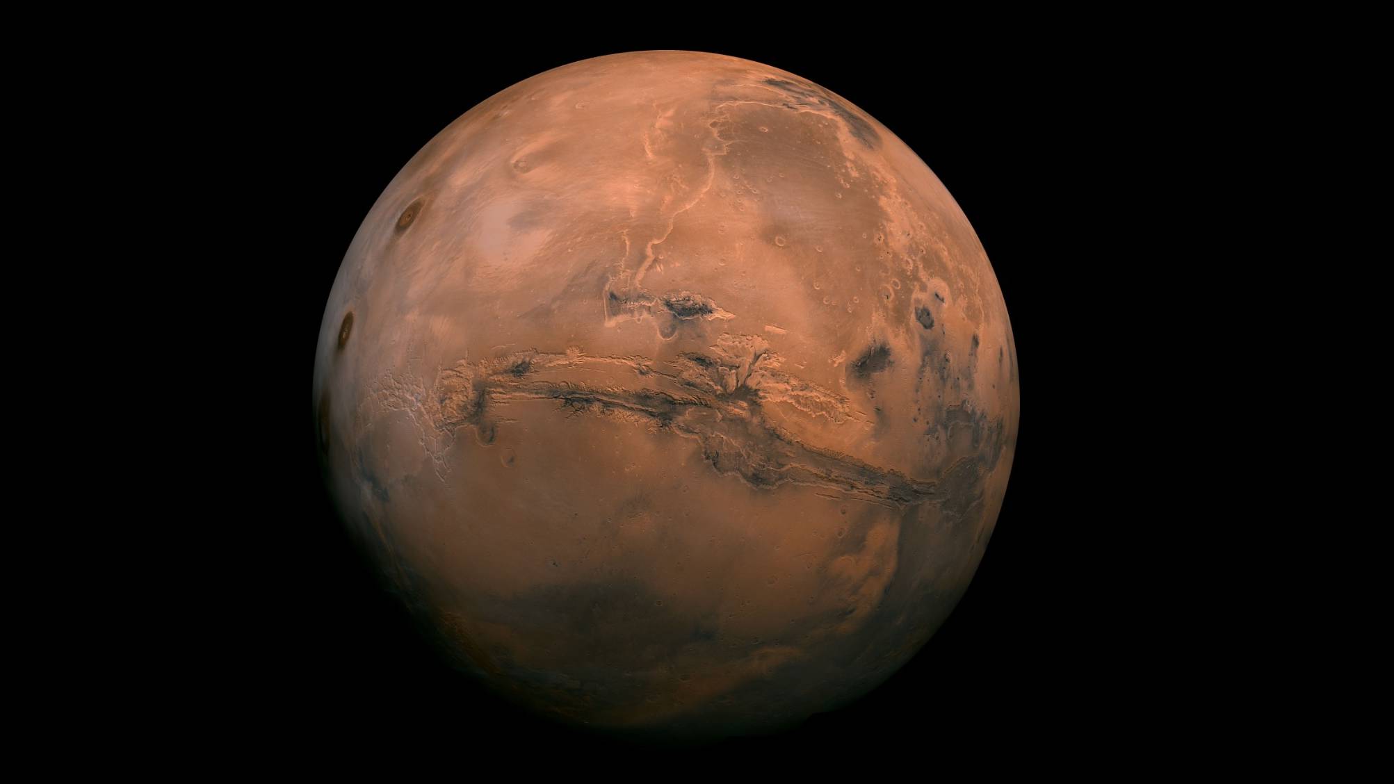
full-disk image of mars taken by an orbiter, showing a long canyon running across the planet's middle

This mosaic is made up of more than 100 images captured by NASA’s Viking 1 orbiter, which operated around Mars from 1976 to 1980. The scar across the center of the planet is the vast Valles Marineris canyon system. (Image credit: NASA/JPL-Caltech)

True positive detections?

Even today, there are some scientists who question whether some of the life-detection experimental results were in fact true positive detections, according to Clark.

"Other scientists believe that it was not enough to simply test the loose soil, but that life in fact may be just centimeters below the surface in areas where there is still ice in the ground," he said.

Clark said that no other planet in our solar system so closely matches the early history of our own planet Earth.

"Recent discoveries by the rovers now roaming Mars have revealed some detections of organic molecules, and even some so-called 'reduction spots,' which are interpreted by some geologists as evidence of activity of biological organisms," he said.

Misunderstood results

Steven Benner is an astrobiochemist and director of the Foundation for Applied Molecular Evolution in Alachua, Florida. He is author of the soon-to-be-issued "Meet the Neighbors: Life on Mars and How to Find It" (Penguin Press, 2026).

Benner has long argued that the results from Viking were misunderstood. He contends that the Red Planet remains an easily reached destination to discover a possible independent origin of life and draws upon the Viking records to spotlight how the scientific process has failed in this regard to date.

Tied to Viking's 50th anniversary, "I decided to write a grumpy 'take no prisoners' book that dispenses with politeness and focuses on the facts," Benner told Space.com.

flyer depicting a spacecraft orbiting mars

Viking flyer from NASA Langley Research Center. The spacecraft were built by Martin Marietta with Langley in Hampton, Virginia managing the Viking project. The Jet Propulsion Laboratory handled the operations of the probes once in flight. (Image credit: Langley Research Center/The Viking Mars Missions Education and Preservation Project)

Misbegotten consensus

Benner said that his new book highlights two tales.

"Viking more likely than not found autotrophic microbial life on Mars, roughly 1,000 cells per gram — about what you might expect based on Earth analogs," said Benner.

The other story, he said, is that communities will defend a misbegotten "consensus" long after that consensus ceases to be defensible. They should not be beholden to a half century of mistakes, he emphasized.

The GCMS misinterpretation was 100% of the grounds for dismissing considerable life-positive data, according to Benner. So, he said, "we should then have gone back to the status quo ante, as Gil Levin did. But since 'consensus' in science is powerful, and Levin was polite, the community marginalized him."

Viking preservation

Rachel Tillman is the founder and executive director of the nonprofit Viking Mars Missions Education and Preservation Project.

Her late father, James Tillman, worked on Viking 1 and 2 and was a professor in the Department of Atmospheric Sciences at the University of Washington.

"There are a variety of reasons it's important to preserve Viking data," Tillman told Space.com. Archiving how and why things were done on Viking from an engineering standpoint is vital, she said, as is safeguarding the science data accumulated during the Viking program.

"Science is dynamic. Instruments and missions are finite in what they collect, so every data is part of a growing body of knowledge coming in pieces of a much larger puzzle. We can't complete the puzzle without all of the data," said Tillman. "So every facet of Mars science is a tiny piece of the puzzle. For that reason, we need to keep all the pieces."

This is true of every engineering success and failure, she added.

"Our organization has records on both. Because of that, we can help industry reduce costs by making the archives available on failed tests as much as successful ones," Tillman said.

It takes many, many missions to get close to answers we theorize on, she pointed out. "And then there is inspiration. By preserving the past — the who, what and how — we inspire youth and the public to support endeavors and even join the workforce," she concluded.
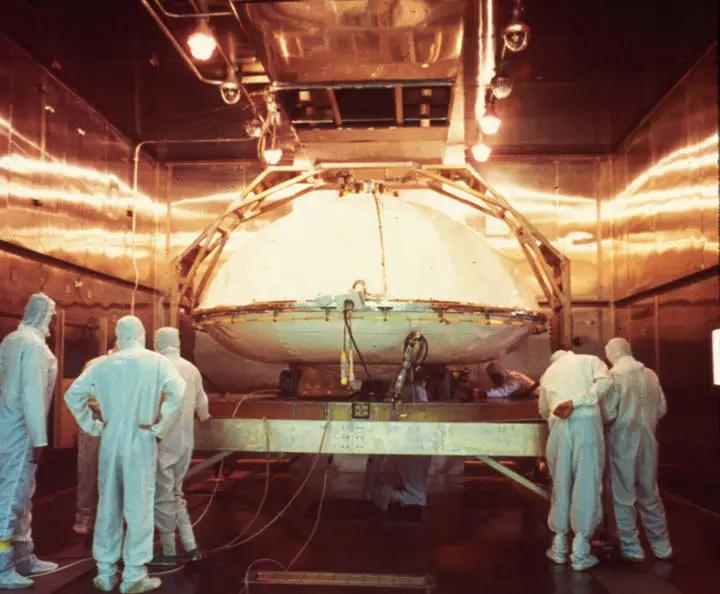
five people in white protective clothing surround a disk-shaped white spacecraft inside a clean room

Space technicians prepare the Viking 1 lander, encased in its bioshield, for its sterilization. (Image credit: NASA)

Contaminate and confuse

"The entire Viking mission — orbiters and landers — are one of the most important sets of data about the planet Mars," said Barry DiGregorio, an honorary research fellow for the Buckingham Center for Astrobiology in the United Kingdom. He is author of "Mars: The Living Planet" (Frog Books/1997).

"Indeed, the Viking biology data have become more important today than they were during the Viking mission," said DiGregorio. "Because Viking carried the very first suite of extant biology instruments to Mars, extreme care was given to the extensive heat sterilization protocols for the Viking landers."

Those protocols ensured that the Vikings did not carry large numbers of terrestrial microorganisms that might contaminate and confuse the actual soil sample results in its three onboard life-detection instruments, DiGregorio said.

Warning flag

However, DiGregorio is also waving a warning flag.

The recent discovery of never-before-detected extremophile microbes in spacecraft assembly clean rooms has made it important to take planetary protection protocols to a new level, said DiGregorio.

"Unfortunately, the search for extant life on Mars has been made much more difficult by unwittingly sending Earth's hardiest extremophile microorganisms there for the last 30 years," he said.

If Mars life is indeed spotted, extra effort will be required "to make sure it isn't earthly extremophile microbes we are detecting," DiGregorio added.

Both Viking landers ceased operating more than four decades ago. But they could still aid the Mars life search today, according to DiGregorio. Perhaps, he said, "comparing any new data found with archived Viking Lander biology data will be crucial in determining their interpretation."
These ‘metallic’ dunes on Mars look like sci-fi. What are they really?

If you still picture Mars as a monotonous red desert, it may be time for an update.

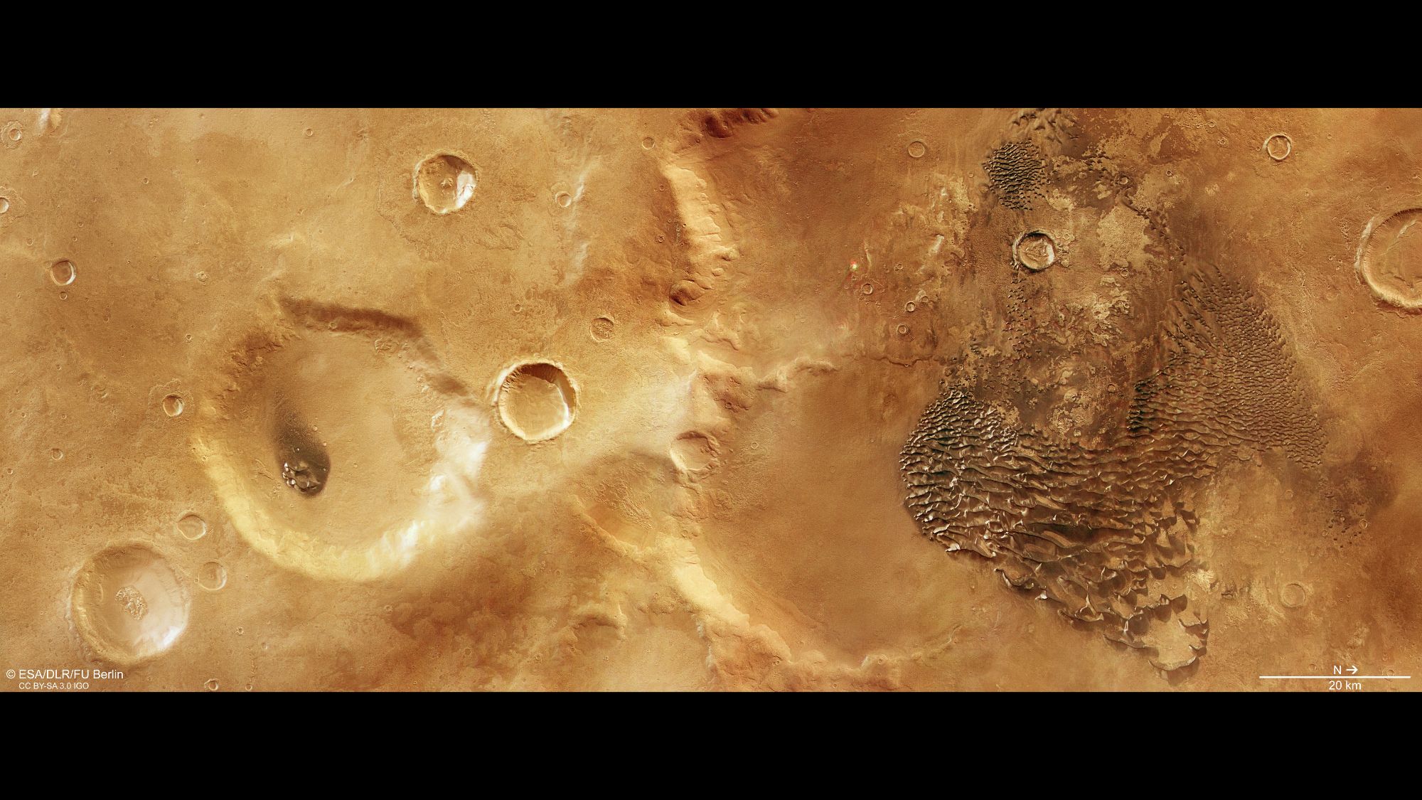
The European Space Agency's Mars Express orbiter has been capturing some of the Red Planet's most surreal landscapes, and its latest images reveal a sprawling field that looks like molten metal frozen across the floor of an ancient Mars crater.

The shimmering "waves" aren't metal at all, however. They are dark sand dunes dusted with seasonal frost, much of it carbon dioxide, or "dry ice," that settles on the surface during Martian winters, giving the dunes their uncanny chrome-like sheen, according to ESA.

The rest is a trick of light and contrast. Because the dark sand absorbs light and the white frost reflects it, the interplay transforms the landscape into something that looks more like a scene from a sci-fi movie than a windswept Martian plain.

Metallic-looking waves on the right side of a reddish region with craters scattered.

A bird's-eye view of wind-blown dunes in Kaiser Crater. (Image credit: ESA/DLR/FU Berlin)

Over thousands of years, Martian winds have sculpted this volcanic sand into dunes that now ripple through the floor of Kaiser Crater, a 129-mile-wide (207-kilometer-wide) impact basin in the planet's southern highlands. The bowl-shaped crater acts as a giant sand trap that prevents the sand from escaping, according to NASA.

The dunes themselves are darker than much of Mars' surface because they are made of fine, basaltic sand rich in volcanic minerals such as pyroxene and olivine, rather than the iron-oxide dust that gives the planet its familiar rusty-red appearance and its famous moniker, the Red Planet.

Because the crater floor remains visible between the ridges, scientists think there is a relatively limited sand supply shaping the field. Still, these ripples of sand are massive, extending for several kilometers and towering more than 100 meters (320 feet) above the surrounding terrain.

The landscape isn't just visually dramatic, it also preserves clues to a time when Mars was a very different world.

Today, Mars is wrapped in an atmosphere little more than a thin veil that is 100 times thinner than Earth's and slowly leaking into space. That makes it harder for winds to lift and transport sand than it is on our own planet. Yet the soaring dunes inside Kaiser Crater show that Martian winds have nonetheless been powerful enough to sculpt vast landscapes over time, perhaps during a period when the Martian atmosphere was thicker a few billion years ago.

The new image adds to a growing collection of striking Martian scenes captured by Mars Express, which has been orbiting the Red Planet since 2003. Just last month, the probe tracked a frenetic cluster of 30 dust devils swirling through the canyons of Mamers Valles, also in the northern hemisphere.

Over the spring and summer, the orbiter similarly spotlighted the planet's vast and complex geological history, from Shalbatana Vallis — carved by groundwater floods about 3.5 billion years ago into winding valleys that span the length of Italy — to a massive blanket of dark volcanic ash elsewhere on the world that has spread across a large chunk of the terrain over just the last 50 years, having either been redistributed by Martian winds or exposed as the overlying dust was blown away.

However desolate Mars may appear from afar, there is certainly no shortage of activity on its surface — or discoveries still waiting to be made.

Smoke from devastating Canada wildfires visible from space | Space photo of the day for July 17, 2026

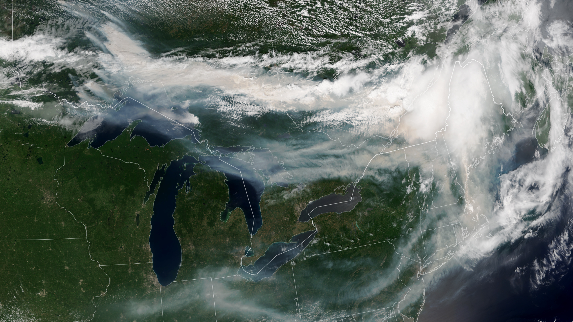
This image from space shows wildfires over Canada.

Smoke from wildfires across Canada travels across both Canada and the U.S. in this satellite image captured by NOAA-21 on July 14, 2026. (Image credit: NASA Earth Observatory/Lauren Dauphin)

The wildfires tearing across Canada are so extreme that the smoke billowing upward can be seen from space.

What is it?

Over 850 wildfires are currently devastating Canada, as reported by the Canadian Interagency Forest Fire Center. The fires are spreading across Manitoba, Saskatchewan and Ontario; most remain completely uncontrolled.

In addition to the immense destruction caused by the fires themselves, the smoke from these fires is causing serious concerns about dangerously poor air quality all across Canada and even in the northeastern United States. As far as New York, the air quality on Thursday (July 16) was labeled "very unhealthy" after the state activated emergency air quality protocols.

The smoke is so expansive it's clearly visible in this image captured on July 14 from Earth orbit.

Why is it noteworthy?

Studying wildfires and wildfire smoke from orbit can give us a bigger picture view of these catastrophic event. This data is important for disaster relief in the short term — but also in the long-term. With climate change continuing to progress due to human activities like burning coal for cheap power, we can expect natural disasters to worsen. Among the many effects of climate change, this includes longer and more intense wildfire seasons, especially in regions that are already susceptible to fire such as these regions across Canada.

The new image was captured by the NOAA-21 satellite with the instrument VIIRS (Visible Infrared Imagine Radiometer Suite). You can see massive plumes of smoke over southeastern Canada treading into the northeastern U.S. Thick smoke covers swaths of Canada's landscape and wisps of smoke trail all the way down through New York and across the U.S.

Most of this smoke, at least the smoke we can see in this satellite image, is coming from wildfires in northwestern Ontario. As the wildfires continue to burn, satellites like NOAA-21 will be keeping watch.

Are we underestimating the threat of solar storms? A ‘once-in-a-thousand-year’ disaster is worth considering, scientists say

The most powerful solar storms to strike Earth may pack a bigger punch than scientists realized, according to a new study that suggests the impacts of extreme space weather have been underestimated.

Researchers found evidence that the apparent upper limit on Earth's response to the strongest solar storms may be an artifact of how solar wind has been measured rather than a true physical ceiling. If confirmed, the findings suggest that rare "once-in-a-thousand-year" geomagnetic storms could have a greater impact on modern technology than current estimates indicate, according to a statement.

"Our planet's magnetic field does a really great job of protecting us against many space weather effects and so they often just show up as glitches or beautiful aurora," Maria Walach, co-author of the study from Lancaster University, said in the statement. "There are however extreme cases."

Solar storms occur when eruptions from the sun, such as coronal mass ejections and solar flares, send clouds of charged particles hurtling toward Earth. While they can produce spectacular auroras, they can also disrupt satellites, GPS, radio communications and power grids.

History has shown the damage even less extreme storms can cause. The 1859 Carrington Event, the strongest geomagnetic storm on record, disrupted telegraph systems around the world and pushed auroras from their usual high-latitude skies near the Arctic and Antarctic to locations as far south as the tropics. Another powerful storm in 1989 collapsed Quebec's power grid, leaving millions without electricity, while the 2003 "Halloween storms" disrupted satellites, GPS and radio communications.

While the study doesn't suggest that an unprecedented solar storm is imminent, it argues that scientists may need to rethink how they estimate the severity of the rarest events — an increasingly important challenge as modern society grows more dependent on satellites and other vulnerable technologies.

The researchers traced the apparent upper limit to where most solar wind measurements are collected. Many observations of extreme events come from spacecraft near the Sun-Earth Lagrange Point 1 (L1), about 1 million miles (1.5 million kilometers) upstream of Earth. Because the strongest solar wind tends to weaken somewhat before reaching Earth, comparing L1 measurements with conditions at our planet can make it appear that Earth's upper atmosphere stops responding to increasingly intense solar wind, even when it does not.

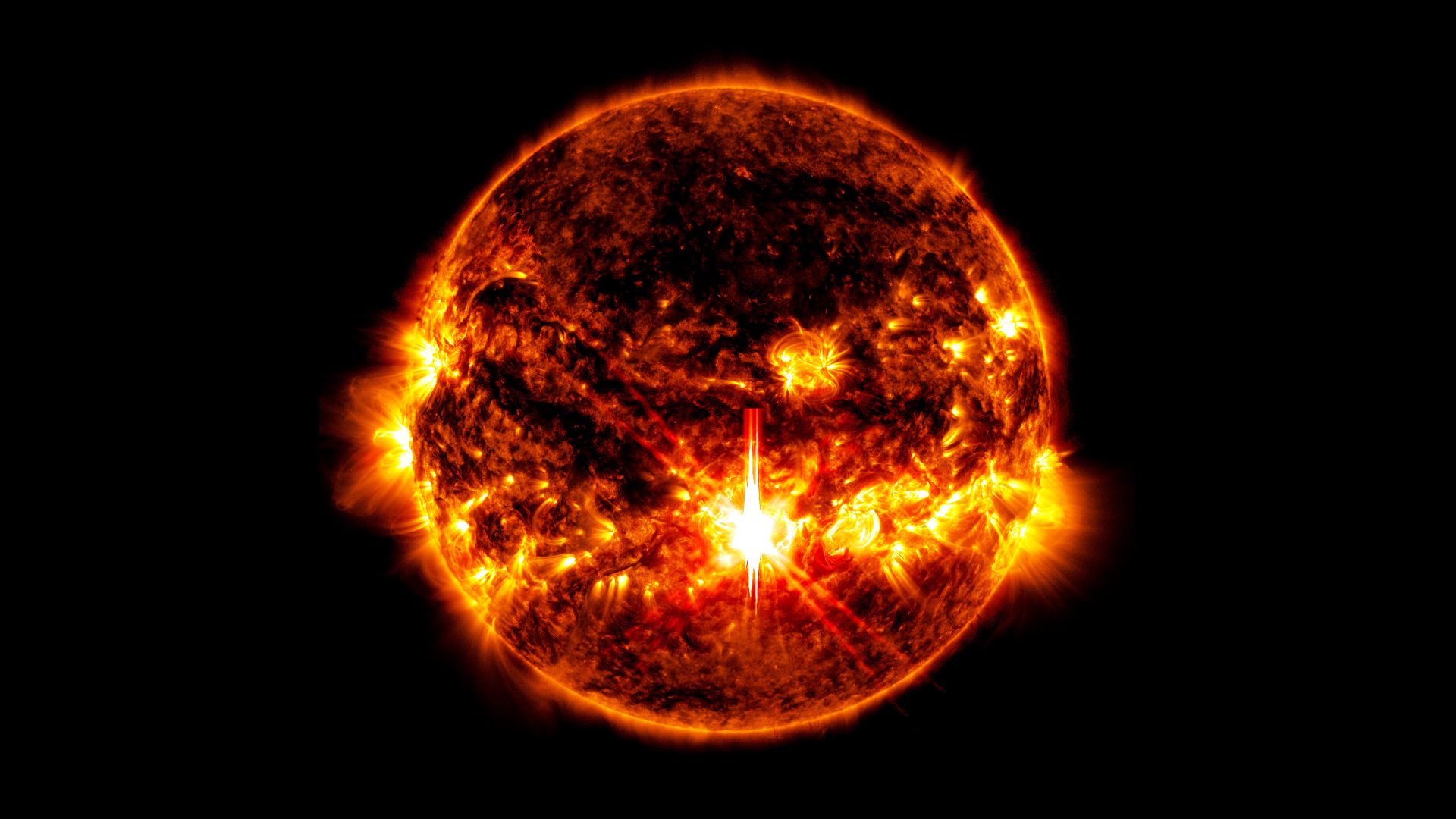
An image of a very violent looking sun against the darkness of space. In the center slightly toward the bottom there is a very bright spot.

A close-up of a solar flare on the sun. (Image credit: NASA/SDO)

To test that idea, the team analyzed more than one million solar wind measurements collected by NASA spacecraft orbiting much closer to Earth, where the solar wind directly interacts with our planet's magnetic field. Those observations showed that electrical currents flowing through Earth's upper atmosphere continued to increase alongside stronger solar wind, with no sign of the previously assumed upper limit. The results suggest that exceptionally powerful solar storms could generate stronger geomagnetic disturbances — and greater impacts on satellites, communications systems and power grids — than earlier estimates predicted.

"Fortunately, these very extreme cases are rare, but this also means we have limited data to work with and only time will tell what happens at the very extreme one-in-a-thousand-year kind of event," Walach said in the statement.

The study comes as the sun remains near the peak of its roughly 11-year solar cycle, known as solar maximum, when sunspots, solar flares and coronal mass ejections become more frequent. During the current cycle, strong geomagnetic storms have repeatedly sent auroras far beyond their usual polar skies.

In May 2024, the strongest geomagnetic storm in more than two decades illuminated skies across much of the United States and Europe while causing intermittent disruptions to high-frequency radio communications, GPS-guided equipment and some satellite operations. Although significant, that event was far less powerful than the Carrington Event — or the even rarer storms the new study suggests may be possible.

The findings were published July 15 in the journal Nature.

Astronomers discover landslides on Pluto large enough to bury entire cities on Earth

The aftermath of landslides have been found in images of Pluto's surface taken when the New Horizons mission flew past the dwarf planet in 2015. The landslides are evidence that the icy world is still active, albeit on geological timescales.

A team led by geologist Marco Emanuele Discenza pored over images taken by New Horizons' LORRI (Long-Range Reconnaissance Imager) instrument, which was capable of detecting surface features as small as 984 feet (300 meters). They found convincing evidence for six landslides in total that have taken place down the inner walls of three craters on the western edge of Sputnik Planitia, the heart-shaped feature that characterizes Pluto's appearance.

Previously, geological features left behind by landslides have been found on a host of bodies in the solar system, including Mars, Ceres in the asteroid belt, some of the icy moons of the gas giants, and even Pluto's companion, Charon. However, these are the first to be found on Pluto.

A landslide that fell 1.4 miles (2.2 kilometers) was identified in Pluto's Coughlin crater, close to a secondary crater on Coughlin's rim that may have triggered the landslide in the first place. Two further landslide features were seen in Giclas crater, and another three were spotted in a third, unnamed, crater.

The landslides were identifiable by their large debris aprons that spilled out onto the crater floors, the distance the landslide material travelled ranging being between 6.3 and 9 miles (10.1 and 14.5 km). Some of these debris aprons appeared bumpy, as if they contain large boulders of solid ice, while the areas around the source of the landslides feature well-defined, concave-shaped cliffs where material has broken away and tumbled down the craters' steep walls.

The great lengths that the debris rolled means that Pluto's landslides are among the most mobile in the solar system, a product of low gravity and low-friction icy rubble. The largest of the debris aprons covers 50 square miles (130 square kilometers), which would be large enough to bury a small city or a large town.

Landslides are important processes in shaping planetary surfaces, enabling the transport of material across great distances. The trigger for Pluto's landslides, however, is not yet clear. While the landslide in Coughlin appears to have been caused by a smaller impact nearby, the other five have less certain origins. One possibility is thermal stresses in the surface ice caused by the slight temperature changes that cause Pluto's volatile materials – among them molecular nitrogen, carbon monoxide and methane – to periodically sublimate and then condense again. These temperature changes are the result of Pluto subtly heating up and cooling down as its elliptical orbit brings it slightly closer to the sun, crossing inside Neptune's orbit, and then moving farther away again.

There is also evidence for more landslides in other craters, but New Horizons' coverage of Pluto's surface was limited as it hurriedly flew past on July 4, 2015, and the imagery required to confirm these other landslides is lacking.

The findings were published in the journal Icarus.

Glaciers spotted flowing across the Himalayas from space | Space photo of the day for July 15, 2026

The Himalaya mountains from space.

Glaciers flow across the Himalaya, as seen from the International Space Station. (Image credit: NASA/Jessica Meir)

Towering glaciers flow down the Himalayas' northern slopes like icy giants cascading onto China's Tibetan Plateau.

What is it?

Back in May, from aboard the International Space Station 259 miles (417 kilometers) above Earth, NASA astronaut Jessica Meir peered out the station's windows with her camera and captured a breathtaking sight.

In that fleeting moment from space, she captured the northern slopes of the Himalaya mountains stretching into China. And atop the mountains, slow-moving rivers of glacial ice carve their way downhill.

This view shows the enormity of this mountain range, which separates Nepal from China's Tibetan Plateau. The Himalayas have the highest mountains in the world, including Mount Everest, with over 110 mountain peaks surpassing 24,000 feet (7,300 meters) of elevation above sea level. Ranging across five countries (Nepal, India, China, Bhutan and Pakistan) the mountain range is about 1,500 miles (2,400 kilometers) wide.

Why is it incredible?

With the range being so incredibly expansive, this view from space offers a unique vantage point from which we can see a large swath of the mountains in motion. Even in a helicopter, you would get a fairly localized view of individual mountains in the Himalayas. This view provides a striking scene that you cannot see from the surface of our planet.

This view is also a reminder of how important space is in our evolving understanding of climate change. As our planet continues to change and sea levels rise with warming temperatures, we can see glacial movement from space. This is an important resource to researchers fighting to better understand climate change so we can better fight it. With access to information about glaciers and how they melt, move and flow across the world, we can be better prepared to protect our planet and its inhabitants.

Honeycomb structures spotted on Mars | Space photo of the day for July 14, 2026

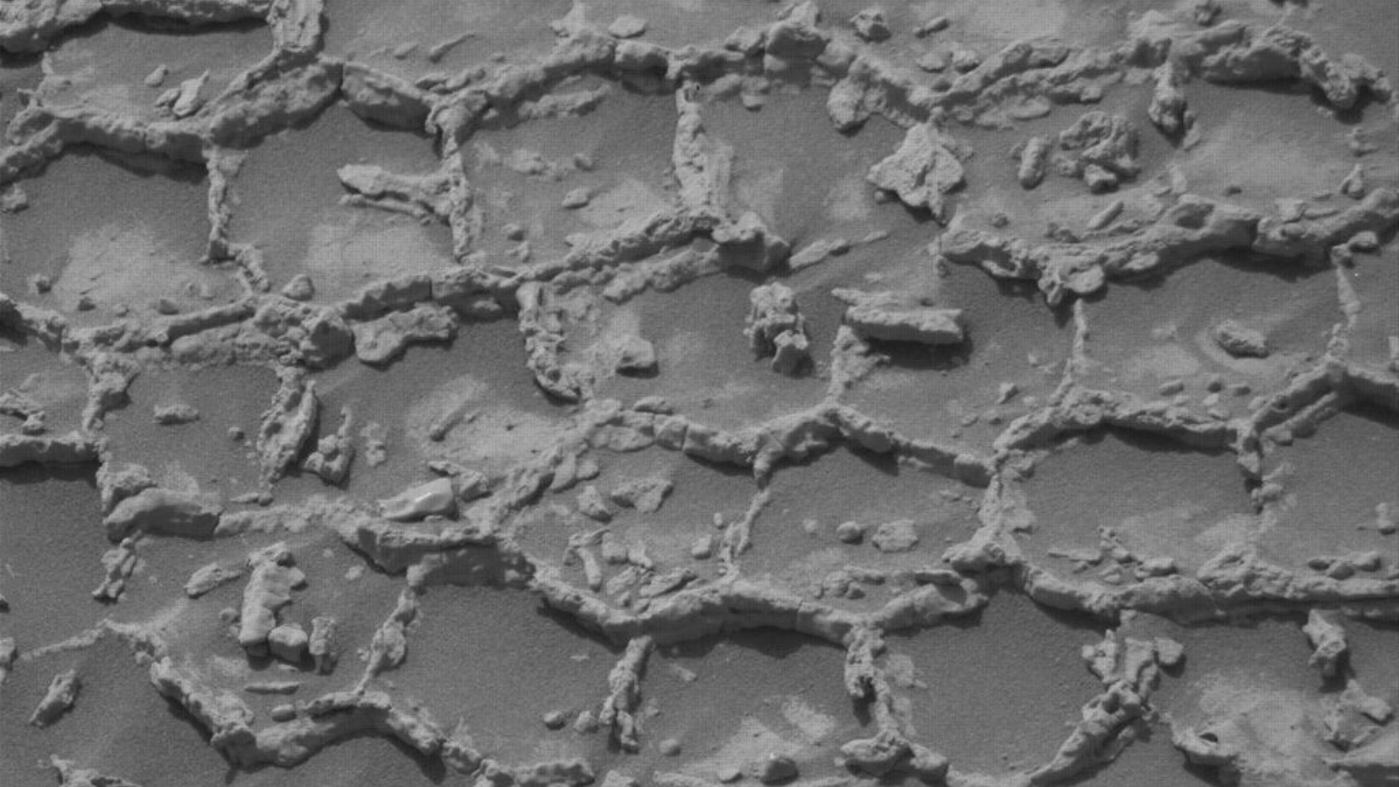
Gray honeycomb material on the Martian surface.

NASA's Mars rover Curiosity spotted these "honeycomb" structures on Mars. (Image credit: NASA/JPL-Caltech/MSSS)

NASA's Curiosity rover has spotted a strange honeycomb texture on the surface of Mars. But what is it?

What is it?

Almost 14 years since landing on the Red Planet, Curiosity is still hard at work exploring. And in new observations, Curiosity has revealed an image that is certainly ... peculiar.

Curiosity went to get a closer look at an area first observed from Mars orbit, and found what appears to be a honeycomb structure in on the planet's surface. Polygonal shapes, nearly identical to one another, make up a pattern almost like a Martian wallpaper or carpet.

But what is it? Why does it look like that? What is a honeycomb doing on Mars?

Why is it incredible?

This is one of many mysteries we have yet to solve on Mars. While the team saw this area first from orbit around the planet, when the rover arrived and saw this structure they were surprised, they shared in a blog post.

In addition to the honeycomb texture, the area was littered with dark rocks and strewn around. But even these pebbles lack explanation. Did they "float" down from higher rock levels, did they launch out of Gale crater during some ancient collision or could they possibly even be meteorites from outside of Mars that ended up strewn across the surface? Researchers think any one of these explanations could be possible.

Previous, similar dark stones have been found on Mars with minerals like nickel that are common in meteorites and uncommon in Mars rocks. But are these similar? Perhaps part of a similar collision event? We don't yet know.

As researchers find new mysteries on Mars, they also continue to find new ways to investigate the unknown. With further study, they will explore both these strange honeycombs and the dark rocks scattered amongst them.

Moon landings could destroy evidence of life’s origins

Landing spacecraft on the moon could contaminate ancient clues about how life may have originated on Earth, a new study finds.

As NASA continues on with its plan of sending astronauts back to the moon with the Artemis program, researchers are exploring what possible unintended consequences may arise from humans visiting the lunar surface. For instance, Artemis IV will land astronauts near the moon's south pole and the agency has future plans for building a longer-term moon base on the lunar surface, which would require many more trips. And indeed, a new study has found the exhaust from spacecraft involved with these landings could expel enough methane to contaminate the moon's surface — possibly destroying molecules that could help to explain how life may have originated on Earth.

"We are trying to protect science and our investment in space," senior study author Silvio Sinibaldi, the planetary protection officer at the European Space Agency, said in a statement. "Our activity can actually hinder scientific exploration."

While experts have had concerns for some time about how rocket launches on Earth pollute our planet and atmosphere, scientists have only really considered this issue with our own planet. This is especially because we haven't been to the moon's surface in over 50 years; concerns of accidental effects of a lunar landing simply haven't been top-of-mind. That's what makes this new study so important. It points to a potential issue that could mean that future moon landings might actually be detrimental to science.

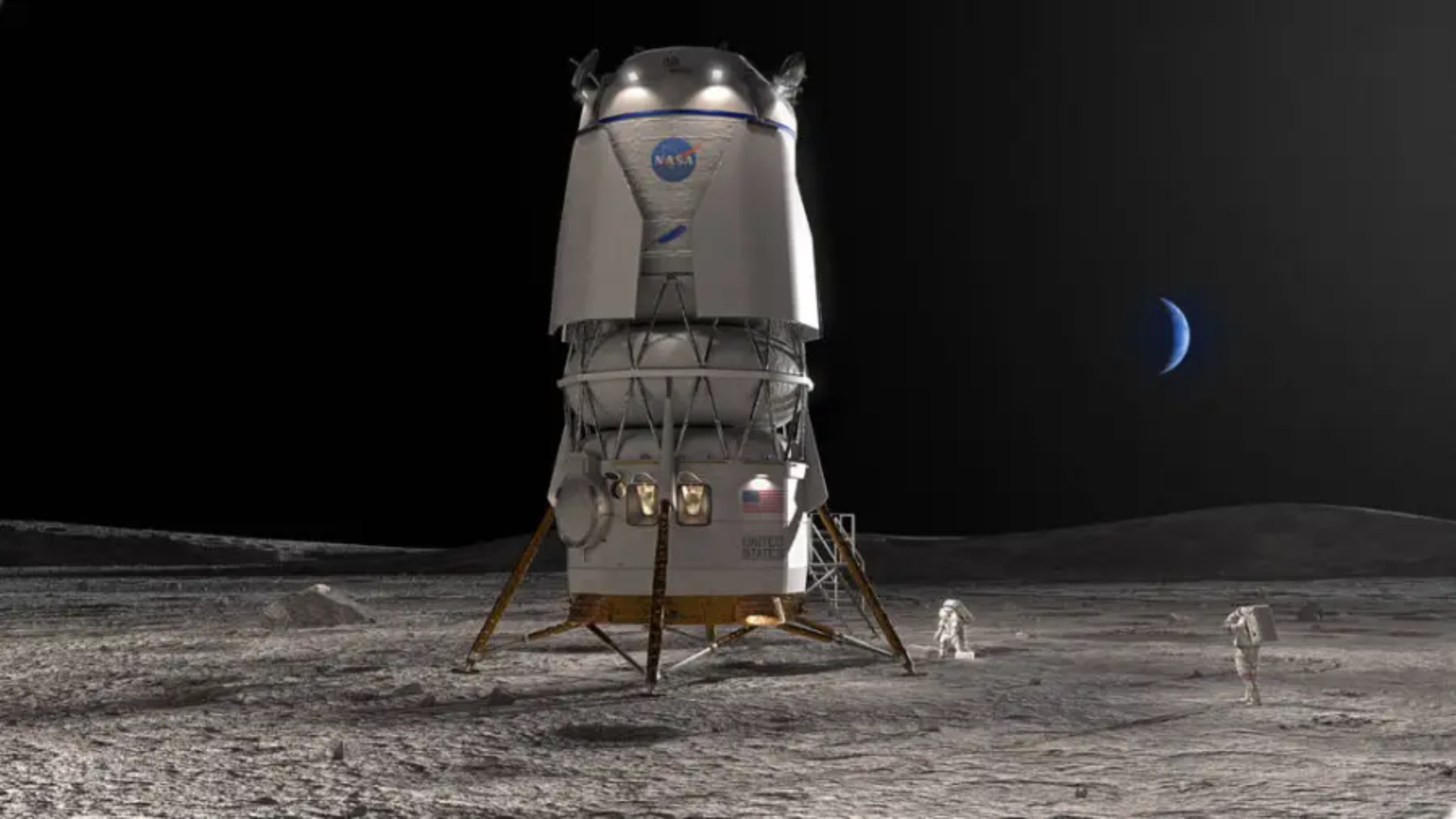
An artist's concept showing Blue Origin's lunar lander on the moon.

An artist's concept of Blue Origin's lunar lander. Lunar landings could pose a serious issue for science on the moon if methane contaminates ancient polar ices, a new study has found. (Image credit: Blue Origin)

Life's clues on the moon?

So why do we think the signs of life could be hiding on the moon? It's actually hiding in ice. Dark craters near the moon's poles, which exist in perpetual shadow, hold ancient ice. This ice is thought to contain material from asteroids and comets that smashed into the moon billions of years ago. Trapped in lunar ice to this day, these bits of ancient collisions could include what the researchers describe as "prebiotic organic molecules," or molecules that could have preceded life on Earth.

It's thought that these molecules from asteroid and comet visitors could have sparked life on Earth, and by studying those possibly trapped on the moon, researchers could be looking at the molecules that ended up combining and creating life as we know it.

The molecular history of life on Earth is pretty much nonexistent on our own planet, as it was largely destroyed by the billions of years of changes we've experienced. But the moon has remained mostly unchanged, so these wells of ice are a uniquely-preserved sampling of pre-life molecules.

"We know we have organic molecules in the solar system — in asteroids, for example," Sinibaldi said. "But how they came to perform specific functions like they do in biological matter is a gap we need to fill."

This ice exists in a somewhat fragile ecosystem, so left alone in darkness, this ice isn't going anywhere anytime soon. But with Artemis, NASA is planning on sending crewed landers to the moon's south pole. That might pose a problem. With computer models in this new study, researchers have shown that the methane exhaust from these landers could very quickly and permanently contaminate this ancient ice, destroying the molecular evidence sealed within.

Inside the simulations

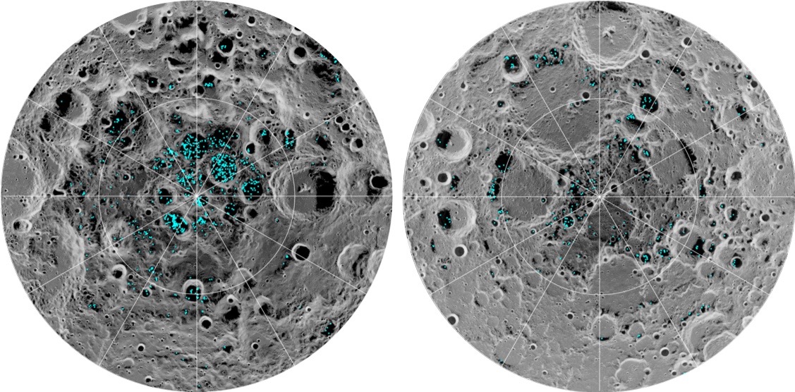
This image shows the distribution of surface ice at the moon’s south pole (left) and north pole (right). Blue represents ice locations, and the gray scale corresponds to surface temperature.

This image shows the distribution of surface ice at the moon’s south pole (left) and north pole (right). Blue represents ice locations, and the gray scale corresponds to surface temperature, with darker gray representing colder areas and lighter shades indicating warmer ones. (Image credit: NASA)

In those computer models, the researchers simulated how methane, the main organic component expelled by planned lunar landers, would spread across the moon's surface after a landing at the south pole. While the simulations included the effects of solar wind and radiation, the moon's lack of an atmosphere caused the methane to spread incredibly quickly, reaching the moon's north pole in under two lunar days.

Within one lunar week (which is roughly seven months on Earth), over half the methane was trapped at the moon's cold polar areas, with a whopping 42% of the substance trapped at the south pole compared to 12% at the north pole. This methane could collect in the same cold pockets where ice and ancient molecules have been collected for billions of years, possibly contaminating this finite, scientific evidence.

"Their trajectories are basically ballistic," lead author Francisca Paiva, a physicist at Instituto Superior Técnico in Portugal, said in the statement. "They just hop around from one point to another."

In better news, there may be a way to circumvent some of this methane disturbance. For instance, the study suggests it's possible that by choosing colder landing sites, scientists can avoid having the methane travel as quickly or as far. Additional simulations are needed to better understand how exhaust compounds travel on the moon, however, as well as the risks that this poses for scientific investigations and if there are other materials lunar trips will involve that could contaminate the environment. Above all, the new study's team emphasizes that as we push toward future lunar exploration, it is key to balance our dreams of settling the moon with preserving its priceless history.

"We have laws regulating contamination of Earth environments like Antarctica and national parks," Paiva said. "I think the moon is an environment as valuable as those."

This work was described in a study published last year in the journal the American Geophysical Union.

‘Reckless’ space-based data centers lack environmental review, drawing criticism

Environmental and scientific organizations are banding together to demand federal environmental reviews of space-based data center projects, which plan to put more than a million new satellites in Earth orbit over the coming years.

Over the last few months, a number of different companies have requested licenses from the U.S. Federal Communications Commission (FCC) to launch data centers into space. SpaceX's proposal alone requests licenses for up to one million satellites in low Earth orbit (LEO). But the requested licenses don't come with any environmental review of the impacts that the satellites — especially collectively — could have on dark skies, wildlife or our atmosphere. In response, a coalition of environmental and scientific organizations represented by the environmental nonprofit Earthjustice have petitioned the FCC for this review.

"Allowing a million orbiting data centers with no environmental review isn’t just irresponsible — it’s reckless," Tim Whitehouse, executive director of Public Employees for Environmental Responsibility, said in a statement on Wednesday (July 8). "The potential for these projects to degrade the atmosphere with pollution and debris and harm wildlife needs to be carefully considered before licensing these projects."

Space is big, but a million new satellites added to LEO to support space-based data centers would be a massive increase. Currently, just Earth orbit harbors just 15,000 active satellites and 46,000 tracked objects overall. This number was already on track to grow to 58,000 active satellites, thanks in large part to SpaceX's ever-growing Starlink broadband megoconstellation, but the data-center plans could make it absolutely explode.

Experts suggest that this significant addition to the technological ecosystem in orbit could have disastrous consequences for life on Earth.

"Drastically expanding satellites in space has a direct impact on people’s everyday lives as well as the future of our planet," Jan Hasselman, senior attorney at Earthjustice, said in the statement. "Agencies that authorize companies looking to space as the next frontier still must operate within the law, and the law requires the FCC to consider all the risks and impacts of these proposals. If we have to sue so that they comply, we will."

The FCC has not yet required any environmental review for satellite companies seeking authorization to deploy in LEO. With its new petition, this coalition aims to change that, asking the FCC to stop granting licenses for orbiting data centers without an environmental review.

What possible environmental harms are they worried about? First of all, as more and more satellites are added to the orbital population, the greater chance there is of collisions, which could produce debris that not only clutters Earth orbit but also increases the risk of additional collisions.

Further the rocket launches that propel the satellites to orbit contribute greenhouse gas emissions to our atmosphere. And the spacecraft cause further pollution when they deorbit, releasing heavy metals and other materials when they burn up in Earth's air.

In addition, a massive increase in satellites will fundamentally change the night sky. Light pollution is known to impact wildlife and ecosystems, disrupting natural rhythms and influencing everything from migration patterns to daily feeding schedules. These disruptions can push animals like bats to miss windows in which insect prey are available, causing them to starve. They can also prevent mountain lions — apex predators that uphold their local ecosystems — from roaming normally at night, fragmenting populations over time, according to the National Wildlife Federation.

The effects of light pollution on wildlife would doubtless grow if suddenly a million new, blinking satellites were added to our night skies. And issues with light pollution extend to our species as well, as life would look quite different if our night skies were much more crowded by bright lights.

"These projects could permanently alter the night sky as we know it," Ruskin Hartley, executive director of DarkSky International, said in the statement. "The FCC needs to take seriously its obligation to ensure these projects do not cause unnecessary harm to naturally dark skies, or to our overall environment."

Take a trip to the turquoise waters of the Bahamas (from space) | Space photo of the day for July 9, 2026

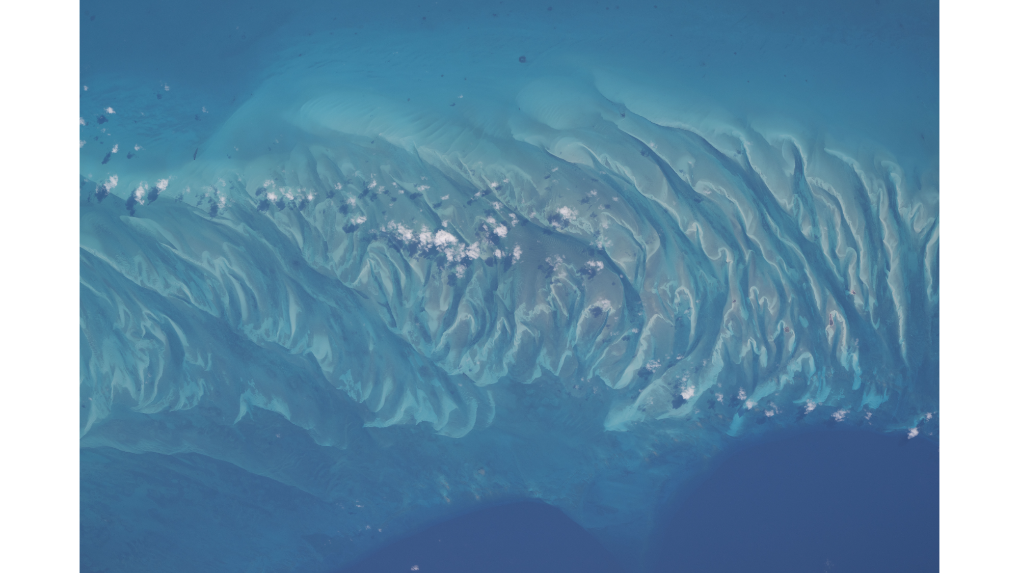
A bright blue and turquoise ocean has a center of waves and ripples of sand with white clouds overhead as seen from above.

Sandbars and waves of rippling sand dunes can be seen from space amongst the turquoise ocean in the Bahamas. (Image credit: NASA/Chris Williams)

If you look at this picture for too long, you might start to hear the waves lapping up against the shore or feel a salty breeze in the air.

You might not have a trip to the Bahamas planned, but you can always enjoy its beauty in this spectacular summertime snapshot captured by NASA astronaut Chris Williams from aboard the International Space Station.

What is it?

In a snapshot that looks straight out of a travel commercial, we can see the crests of rippling waves of sand peeking out from beneath turquoise waters off the coast of the island Eleuthera in the Bahamas.

The moment was captured 263 miles (423 kilometers) above Earth's Atlantic Ocean from aboard the space station orbiting our planet.

This isn't the first fun snapshot captured by Williams who also recently flexed his muscles for a photo mid-spacewalk.

Why is it incredible?

This photo is incredibly beautiful. That much is immediately obvious. And if you've ever swam in picturesque waters like this, then you know how calming and magical such places on Earth can be.

But this photo is more than just pretty, as it shows that we can see Earth's beauty from 263 miles away. It is a reminder that our planet is truly special. Imagine if a future mission saw beauty like this from space on a far off exoplanet, or even a planet outside of our solar system. Currently, our planet is the only one we know of with views like this, but it's possible that in the future we might find tropical shorelines and vacation vistas aren't exclusive to our home planet.